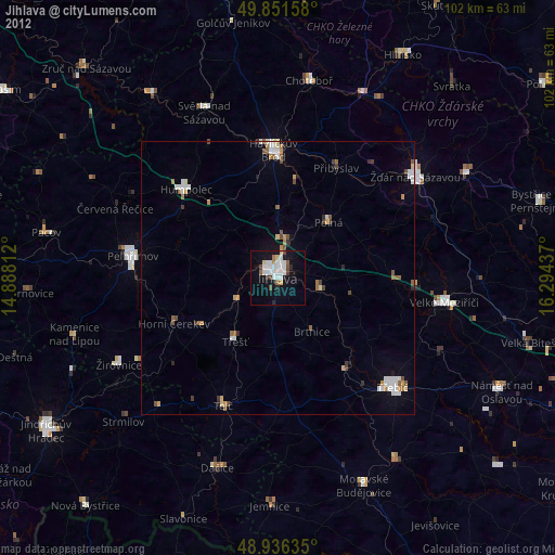
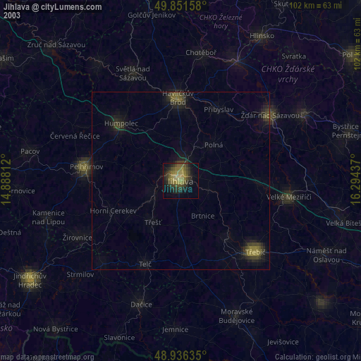
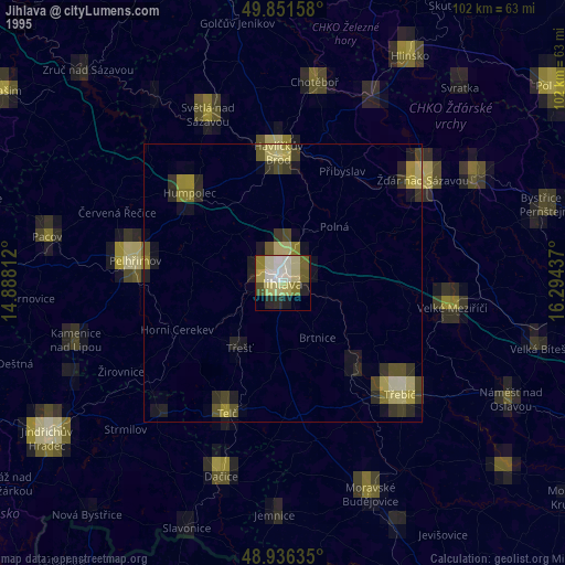
Jihlava night lights from space
Night Light of Jihlava (Vysočina) from space (Czech Republic) Src. Average luminocity for 10x10km area is 20.2794% and for 50x50km: 2.839%.
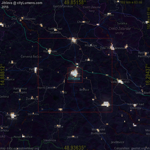
Analysis of Jihlava night lights 2016
Square area 10x10 km:
 6.28%
6.28%90-99
4.41%80-89
0.27%70-79
0.8%60-69
0.94%50-59
2.94%40-49
0.8%30-39
0.94%20-29
1.74%10-19
23.4%0-9
57.49%Square area 50x50 km:
0.59%90-99
0.6%80-89
0.23%70-79
0.15%60-69
0.17%50-59
0.38%40-49
0.32%30-39
0.3%20-29
0.21%10-19
1.97%0-9
95.07%Clear (daylight) street map image can be seen on geolist.org.
Map coordinates:
49° 51' 5.7" North, 14° 53' 17.2" East
49° 23' 46" North, 15° 35' 28.5" East
48° 56' 10.9" North, 16° 17' 39.7" East
Some cities around Jihlava sort by population:
• Třebíč
29.1 km =18.1 mi,  133°
133°
• Havlíčkův Brod
23.5 km =14.6 mi,  357°
357°
• Pelhřimov
26.9 km =16.7 mi,  278°
278°
• Velké Meziříčí
30.8 km =19.1 mi,  98°
98°
• Humpolec
23.3 km =14.5 mi,  313°
313°
• Třešť
14.1 km =8.8 mi,  214°
214°
• Telč
25.6 km =15.9 mi,  203°
203°
• Polná
13.7 km =8.5 mi,  42°
42°
3074199 (p: 50,100)
Sources (retrieved 2019-11-25):
» NASA, Earths city lights 1995
» NASA city lights 2003
» Earth at Night: Flat Maps 2012, 2016