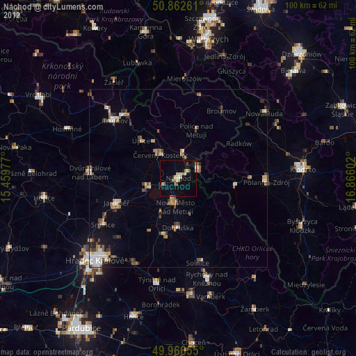
Náchod night lights from space
Night Light of Náchod (Královéhradecký kraj) from space (Czech Republic) Src. Average luminocity for 10x10km area is 11.2619% and for 50x50km: 3.8812%.
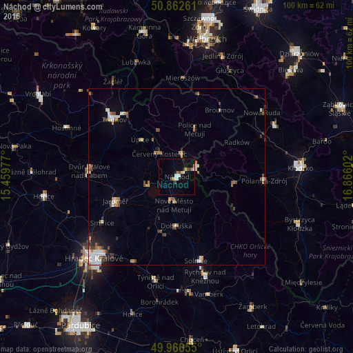
Analysis of Náchod night lights 2016
Square area 10x10 km:
 0.98%
0.98%90-99
2.66%80-89
0.56%70-79
1.68%60-69
0.7%50-59
0.28%40-49
2.24%30-39
0.98%20-29
0.84%10-19
3.78%0-9
85.29%Square area 50x50 km:
0.6%90-99
0.71%80-89
0.23%70-79
0.38%60-69
0.64%50-59
0.49%40-49
0.59%30-39
0.51%20-29
0.6%10-19
1.29%0-9
93.96%Clear (daylight) street map image can be seen on geolist.org.
Map coordinates:
50° 51' 45.4" North, 15° 27' 35.2" East
50° 25' 0.1" North, 16° 9' 46.4" East
49° 57' 59.6" North, 16° 51' 57.7" East
Some cities around Náchod sort by population:
• Jaroměř
18.4 km =11.4 mi,  248°
248°
• Kudowa-Zdrój, PL
6.4 km =4 mi,  63°
63°
• Nové Město nad Metují
8.1 km =5 mi,  185°
185°
• Červený Kostelec
8.3 km =5.2 mi,  323°
323°
• Dobruška
13.9 km =8.6 mi,  180°
180°
• Hronov
7.1 km =4.4 mi,  11°
11°
• Úpice
14.9 km =9.3 mi, 315°
• Česká Skalice
8.9 km =5.5 mi, 253°
3070122 (p: 21,263)
Sources (retrieved 2019-11-25):
» Earth at Night: Flat Maps 2012, 2016