Česká Skalice night lights from space
Night Light of Česká Skalice (Královéhradecký kraj) from space (Czech Republic) Src. Average luminocity for 10x10km area is 2.3333% and for 50x50km: 4.7454%.
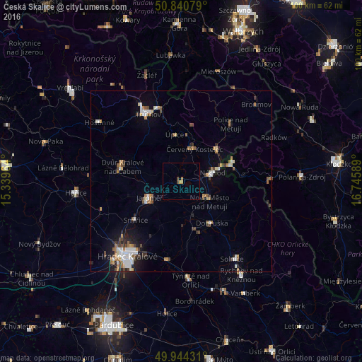
Analysis of Česká Skalice night lights 2016
Square area 10x10 km:
 0%
0%90-99
0%80-89
0.14%70-79
0.98%60-69
0.56%50-59
0%40-49
1.12%30-39
0%20-29
0%10-19
0.28%0-9
96.92%Square area 50x50 km:
0.69%90-99
0.91%80-89
0.3%70-79
0.55%60-69
0.79%50-59
0.47%40-49
0.76%30-39
0.49%20-29
0.8%10-19
2.05%0-9
92.19%Clear (daylight) street map image can be seen on geolist.org.
Map coordinates:
50° 50' 26.8" North, 15° 20' 22.7" East
50° 23' 40.8" North, 16° 2' 33.9" East
49° 56' 39.5" North, 16° 44' 45.2" East
Some cities around Česká Skalice sort by population:
• Náchod
8.9 km =5.5 mi,  73°
73°
• Jaroměř
9.6 km =6 mi,  243°
243°
• Kudowa-Zdrój, PL
15.2 km =9.4 mi, 69°
• Nové Město nad Metují
9.5 km =5.9 mi,  125°
125°
• Červený Kostelec
9.7 km =6 mi,  21°
21°
• Dobruška
14.1 km =8.8 mi,  143°
143°
• Hronov
13.7 km =8.5 mi,  46°
46°
• Úpice
13.2 km =8.2 mi,  351°
351°
3077921 (p: 5,402)
Sources (retrieved 2019-11-25):
» Earth at Night: Flat Maps 2012, 2016