Chlumec nad Cidlinou night lights from space
Night Light of Chlumec nad Cidlinou (Královéhradecký kraj) from space (Czech Republic) Src. Average luminocity for 10x10km area is 3.4011% and for 50x50km: 5.8902%.
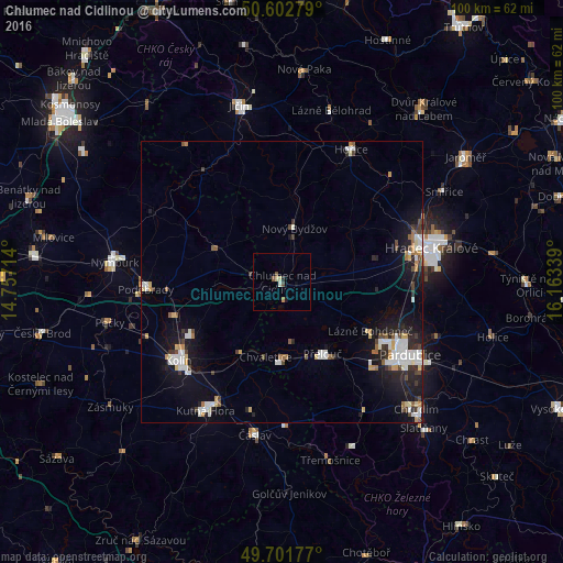
Analysis of Chlumec nad Cidlinou night lights 2016
Square area 10x10 km:
 0%
0%90-99
0.8%80-89
0.8%70-79
0%60-69
0.53%50-59
0.53%40-49
1.07%30-39
0%20-29
0.53%10-19
0.8%0-9
94.92%Square area 50x50 km:
1.08%90-99
1.26%80-89
0.44%70-79
0.58%60-69
0.4%50-59
0.45%40-49
0.83%30-39
0.61%20-29
1.35%10-19
4.52%0-9
88.48%Clear (daylight) street map image can be seen on geolist.org.
Map coordinates:
50° 36' 10" North, 14° 45' 25.7" East
50° 9' 15.8" North, 15° 27' 36.9" East
49° 42' 6.4" North, 16° 9' 48.2" East
Some cities around Chlumec nad Cidlinou sort by population:
• Hradec Králové
27.2 km =16.9 mi,  77°
77°
• Pardubice
25.9 km =16.1 mi,  119°
119°
• Kolín
23.3 km =14.5 mi,  232°
232°
• Kutná Hora
26.7 km =16.6 mi,  210°
210°
• Poděbrady
24.4 km =15.2 mi,  266°
266°
• Hořice
26.5 km =16.5 mi,  27°
27°
• Přelouč
14.6 km =9.1 mi,  150°
150°
• Nový Bydžov
9.9 km =6.2 mi,  12°
12°
3077751 (p: 5,292)
Sources (retrieved 2019-11-25):
» Earth at Night: Flat Maps 2012, 2016