Sagua la Grande night lights from space
Night Light of Sagua la Grande (Villa Clara) from space (Cuba) Src. Average luminocity for 10x10km area is 16.8135% and for 50x50km: 2.2713%.
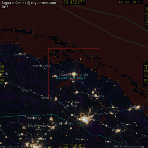
Analysis of Sagua la Grande night lights 2016
Square area 10x10 km:
 0.4%
0.4%90-99
0.79%80-89
3.37%70-79
3.77%60-69
1.59%50-59
4.56%40-49
4.17%30-39
1.59%20-29
0%10-19
4.76%0-9
75%Square area 50x50 km:
0.02%90-99
0.06%80-89
0.4%70-79
0.6%60-69
0.34%50-59
0.5%40-49
0.56%30-39
0.28%20-29
0.23%10-19
0.45%0-9
96.55%Clear (daylight) street map image can be seen on geolist.org.
Map coordinates:
23° 27' 11.8" North, 80° 46' 43.3" West
22° 48' 24" North, 80° 4' 32" West
22° 9' 25.2" North, 79° 22' 20.8" West
Some cities around Sagua la Grande sort by population:
• Santa Clara
45.9 km =28.5 mi,  165°
165°
• Santo Domingo
29.9 km =18.6 mi,  215°
215°
• Ranchuelo
48.9 km =30.4 mi,  189°
189°
• Cifuentes
17.7 km =11 mi, 171°
• Encrucijada
30 km =18.6 mi,  134°
134°
• Quemado de Güines
18.2 km =11.3 mi,  263°
263°
• Esperanza
40.1 km =24.9 mi,  183°
183°
• Calabazar de Sagua
25.8 km =16 mi, 134°
3541440 (p: 62,073)
Sources (retrieved 2019-11-25):
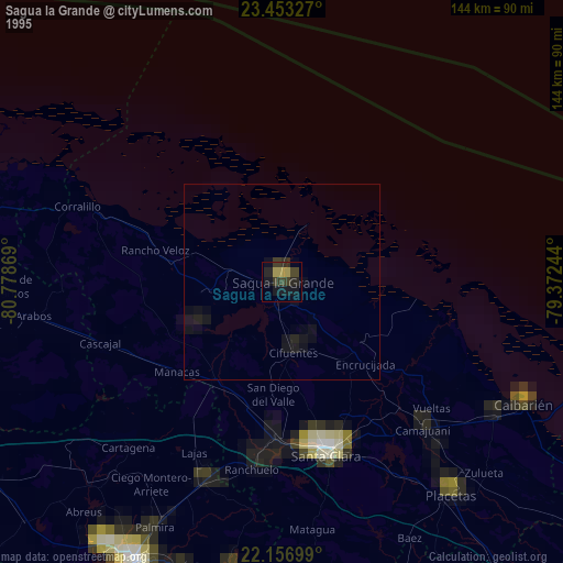
» NASA, Earths city lights 1995
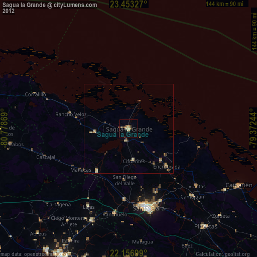
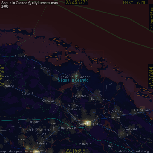
» NASA city lights 2003
» Earth at Night: Flat Maps 2012, 2016