Cifuentes night lights from space
Night Light of Cifuentes (Villa Clara) from space (Cuba) Src. Average luminocity for 10x10km area is 3.5893% and for 50x50km: 4.2479%.
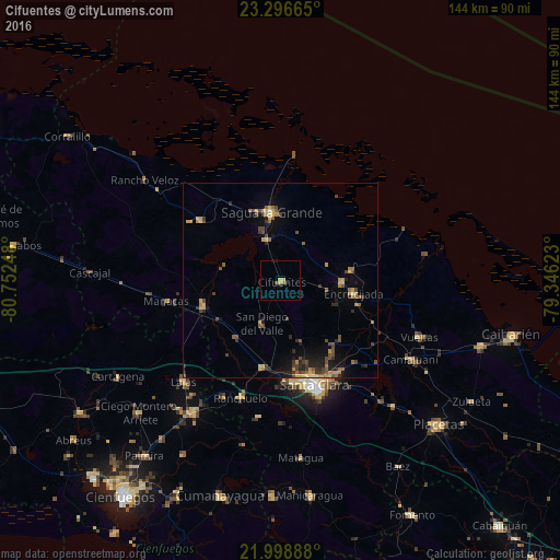
Analysis of Cifuentes night lights 2016
Square area 10x10 km:
 0%
0%90-99
0%80-89
0.79%70-79
1.39%60-69
0.99%50-59
0.6%40-49
0.2%30-39
0%20-29
0.79%10-19
1.59%0-9
93.65%Square area 50x50 km:
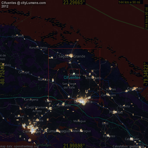
0.02%90-99
0.06%80-89
0.55%70-79
0.99%60-69
0.59%50-59
0.86%40-49
1.36%30-39
0.63%20-29
1.14%10-19
1.95%0-9
91.85%Clear (daylight) street map image can be seen on geolist.org.
Map coordinates:
23° 17' 47.9" North, 80° 45' 8.9" West
22° 38' 57.5" North, 80° 2' 57.7" West
21° 59' 56" North, 79° 20' 46.4" West
Some cities around Cifuentes sort by population:
• Santa Clara
28.3 km =17.6 mi,  162°
162°
• Sagua la Grande
17.7 km =11 mi,  351°
351°
• Santo Domingo
21 km =13 mi,  250°
250°
• Ranchuelo
32.5 km =20.2 mi,  198°
198°
• Encrucijada
19.1 km =11.9 mi,  100°
100°
• Quemado de Güines
25.9 km =16.1 mi,  306°
306°
• Esperanza
23 km =14.3 mi,  192°
192°
• Calabazar de Sagua
15.8 km =9.8 mi,  91°
91°
3564114 (p: 40,142)
Sources (retrieved 2019-11-25):
» Earth at Night: Flat Maps 2012, 2016