Quivicán night lights from space
Night Light of Quivicán (Mayabeque) from space (Cuba) Src. Average luminocity for 10x10km area is 18.496% and for 50x50km: 21.2984%.
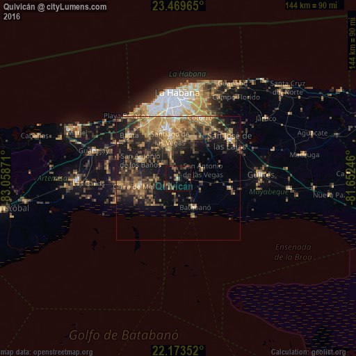
Analysis of Quivicán night lights 2016
Square area 10x10 km:
 0%
0%90-99
0.79%80-89
0.6%70-79
1.98%60-69
3.37%50-59
3.17%40-49
8.13%30-39
5.36%20-29
3.57%10-19
21.83%0-9
51.19%Square area 50x50 km:
0.49%90-99
1%80-89
2%70-79
6.42%60-69
3.87%50-59
3.74%40-49
6.03%30-39
4.99%20-29
6.45%10-19
14.45%0-9
50.57%Clear (daylight) street map image can be seen on geolist.org.
Map coordinates:
23° 28' 10.7" North, 83° 3' 31.4" West
22° 49' 23.3" North, 82° 21' 20.1" West
22° 10' 24.7" North, 81° 39' 8.9" West
Some cities around Quivicán sort by population:
• Boyeros
21 km =13 mi,  347°
347°
• Güira de Melena
15.8 km =9.8 mi,  259°
259°
• San Antonio de los Baños
16.7 km =10.4 mi,  296°
296°
• Santiago de las Vegas
16.6 km =10.3 mi, 348°
• La Salud
8.8 km =5.5 mi,  308°
308°
• Bejucal
12.2 km =7.6 mi,  343°
343°
• Alquízar
23.5 km =14.6 mi,  265°
265°
• Batabanó
13.5 km =8.4 mi,  149°
149°
3542965 (p: 12,919)
Sources (retrieved 2019-11-25):
» Earth at Night: Flat Maps 2012, 2016