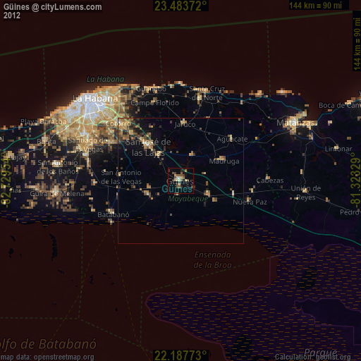
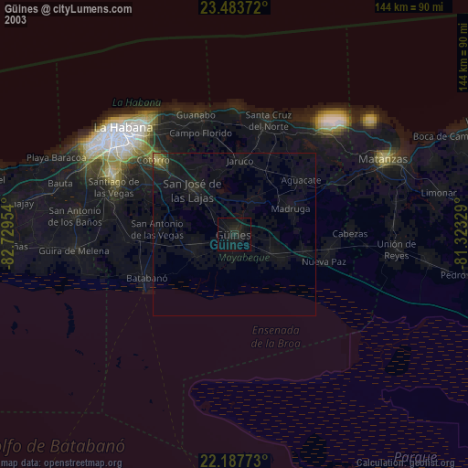
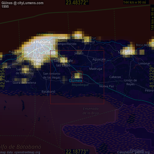
Güines night lights from space
Night Light of Güines (Mayabeque) from space (Cuba) Src. Average luminocity for 10x10km area is 20.6171% and for 50x50km: 6.7264%.
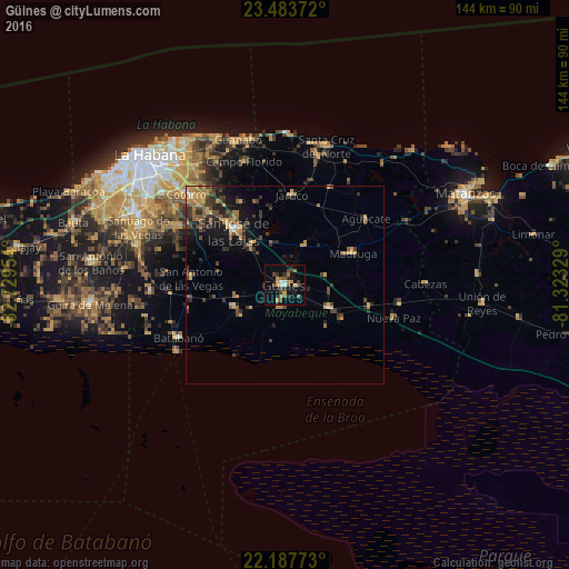
Analysis of Güines night lights 2016
Square area 10x10 km:
 0.6%
0.6%90-99
1.79%80-89
1.98%70-79
3.77%60-69
4.37%50-59
2.98%40-49
5.16%30-39
5.36%20-29
2.18%10-19
9.92%0-9
61.9%Square area 50x50 km:
0.1%90-99
0.34%80-89
0.57%70-79
1.73%60-69
1.21%50-59
0.97%40-49
1.75%30-39
1.71%20-29
1.68%10-19
3.79%0-9
86.15%Clear (daylight) street map image can be seen on geolist.org.
Map coordinates:
23° 29' 1.4" North, 82° 43' 46.3" West
22° 50' 14.2" North, 82° 1' 35.1" West
22° 11' 15.8" North, 81° 19' 23.8" West
Some cities around Güines sort by population:
• San José de las Lajas
18.8 km =11.7 mi,  317°
317°
• Madruga
19.2 km =11.9 mi,  65°
65°
• Jaruco
23.1 km =14.4 mi,  4°
4°
• Santa Cruz del Norte
36.7 km =22.8 mi,  16°
16°
• Jamaica
21.2 km =13.2 mi, 316°
• San Nicolás de Bari
13 km =8.1 mi,  116°
116°
• Batabanó
30.1 km =18.7 mi,  243°
243°
• Quivicán
33.8 km =21 mi,  267°
267°
3557378 (p: 68,935)
Sources (retrieved 2019-11-25):
» NASA, Earths city lights 1995
» NASA city lights 2003
» Earth at Night: Flat Maps 2012, 2016