Cienfuegos night lights from space
Night Light of Cienfuegos from space (Cuba) Src. Average luminocity for 10x10km area is 48.2083% and for 50x50km: 6.4334%.
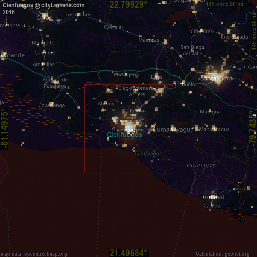
Analysis of Cienfuegos night lights 2016
Square area 10x10 km:
 5.95%
5.95%90-99
7.34%80-89
15.28%70-79
8.33%60-69
4.56%50-59
4.56%40-49
3.97%30-39
1.59%20-29
17.06%10-19
27.58%0-9
3.77%Square area 50x50 km:
0.31%90-99
0.35%80-89
1.42%70-79
0.97%60-69
0.61%50-59
0.84%40-49
1.38%30-39
1.13%20-29
1.79%10-19
4.82%0-9
86.39%Clear (daylight) street map image can be seen on geolist.org.
Map coordinates:
22° 47' 57.4" North, 81° 8' 59.1" West
22° 8' 58.5" North, 80° 26' 47.8" West
21° 29' 48.6" North, 79° 44' 36.6" West
Some cities around Cienfuegos sort by population:
• Ranchuelo
39.3 km =24.4 mi,  50°
50°
• Manicaragua
48.2 km =30 mi,  89°
89°
• Cumanayagua
25 km =15.5 mi, 89°
• Cruces
28.1 km =17.5 mi,  40°
40°
• Palmira
11.7 km =7.3 mi,  29°
29°
• Lajas
33.5 km =20.8 mi, 28°
• Rodas
24.2 km =15 mi,  332°
332°
• Abreus
19.1 km =11.9 mi,  318°
318°
3564124 (p: 186,644)
Sources (retrieved 2019-11-25):
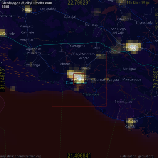
» NASA, Earths city lights 1995
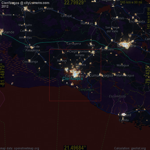
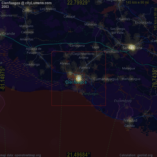
» NASA city lights 2003
» Earth at Night: Flat Maps 2012, 2016