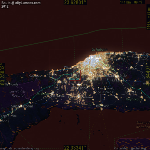
Bauta night lights from space
Night Light of Bauta (Artemisa) from space (Cuba) Src. Average luminocity for 10x10km area is 34.9107% and for 50x50km: 29.4655%.
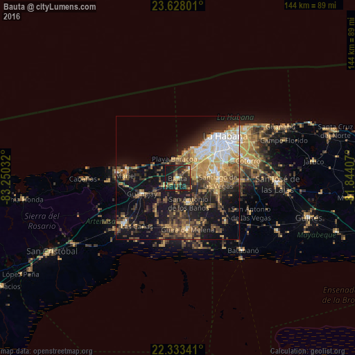
Analysis of Bauta night lights 2016
Square area 10x10 km:
 0.99%
0.99%90-99
1.39%80-89
1.59%70-79
11.11%60-69
2.78%50-59
5.56%40-49
8.73%30-39
10.91%20-29
22.82%10-19
33.53%0-9
0.6%Square area 50x50 km:
3.61%90-99
3.69%80-89
3.16%70-79
6.73%60-69
3.67%50-59
3.76%40-49
6.17%30-39
5.57%20-29
7.51%10-19
19.73%0-9
36.41%Clear (daylight) street map image can be seen on geolist.org.
Map coordinates:
23° 37' 40.8" North, 83° 15' 1.2" West
22° 58' 56.1" North, 82° 32' 49.9" West
22° 20' 0.3" North, 81° 50' 38.7" West
Some cities around Bauta sort by population:
• Arroyo Naranjo
19.2 km =11.9 mi,  71°
71°
• Boyeros
15.1 km =9.4 mi,  79°
79°
• San Antonio de los Baños
11.3 km =7 mi,  155°
155°
• Santiago de las Vegas
16.5 km =10.3 mi,  94°
94°
• La Salud
17.6 km =10.9 mi,  134°
134°
• Guanajay
15.7 km =9.8 mi,  246°
246°
• Bejucal
17.3 km =10.7 mi,  110°
110°
• Alquízar
20 km =12.4 mi,  190°
190°
3567612 (p: 45,768)
Sources (retrieved 2019-11-25):
» Earth at Night: Flat Maps 2012, 2016