San Rafael night lights from space
Night Light of San Rafael (San José) from space (Costa Rica) Src. Average luminocity for 10x10km area is 84.9876% and for 50x50km: 31.2109%.
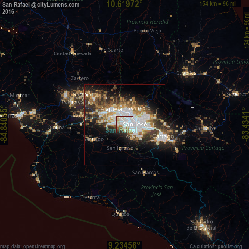
Analysis of San Rafael night lights 2016
Square area 10x10 km:
 42.98%
90-99
20.66%80-89
10.74%70-79
1.86%60-69
9.09%50-59
4.55%40-49
1.86%30-39
4.34%20-29
3.72%10-19
0.21%0-9
0%Square area 50x50 km:
7.74%90-99
6.27%80-89
2.95%70-79
2.88%60-69
4.71%50-59
4.44%40-49
4.52%30-39
4.95%20-29
6.61%10-19
9.3%0-9
45.63%Clear (daylight) street map image can be seen on geolist.org.
Map coordinates:
10° 37' 11" North, 84° 50' 25.3" West
9° 55' 40.3" North, 84° 8' 14" West
9° 14' 4.4" North, 83° 26' 2.8" West
Some cities around San Rafael sort by population:
• San José
5.9 km =3.7 mi,  84°
84°
• San Francisco
7.3 km =4.5 mi,  6°
6°
• San Juan
7 km =4.3 mi,  59°
59°
• San Felipe
4.3 km =2.7 mi,  126°
126°
• Colima
6.3 km =3.9 mi,  65°
65°
• Alajuelita
5 km =3.1 mi, 125°
• Escazú
1 km =0.6 mi,  196°
196°
• Santa Ana
5 km =3.1 mi,  276°
276°
3621689 (p: 25,410)
Sources (retrieved 2019-11-25):
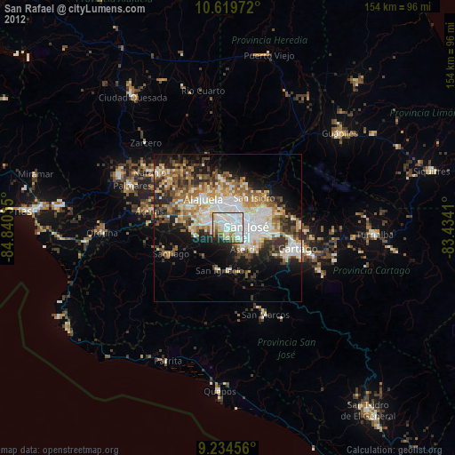
» Earth at Night: Flat Maps 2012, 2016