Quibdó night lights from space
Night Light of Quibdó (Chocó) from space (Colombia) Src. Average luminocity for 10x10km area is 12.3698% and for 50x50km: 1.124%.
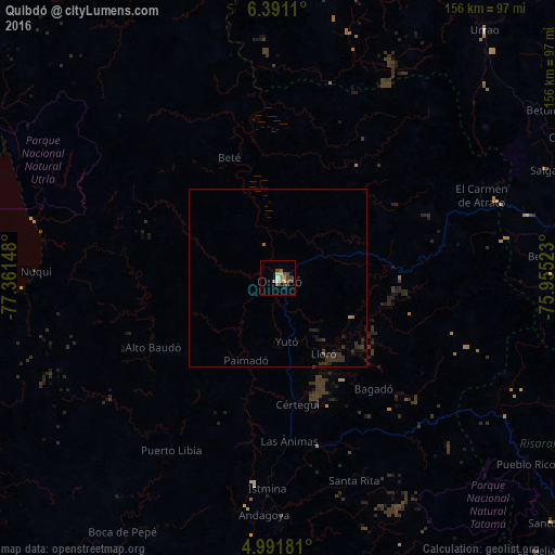
Analysis of Quibdó night lights 2016
Square area 10x10 km:
 0.62%
0.62%90-99
1.03%80-89
1.86%70-79
1.45%60-69
1.45%50-59
2.89%40-49
5.17%30-39
2.07%20-29
0.21%10-19
0.62%0-9
82.64%Square area 50x50 km:
0.03%90-99
0.04%80-89
0.08%70-79
0.08%60-69
0.15%50-59
0.15%40-49
0.23%30-39
0.81%20-29
0.45%10-19
0.35%0-9
97.63%Clear (daylight) street map image can be seen on geolist.org.
Map coordinates:
6° 23' 28" North, 77° 21' 41.3" West
5° 41' 30.8" North, 76° 39' 30.1" West
4° 59' 30.5" North, 75° 57' 18.8" West
Some cities around Quibdó sort by population:
• Urrao
90.5 km =56.2 mi,  39°
39°
• Andes
86.3 km =53.6 mi,  92°
92°
• Ciudad Bolívar
72.3 km =44.9 mi,  75°
75°
• Istmina
59.1 km =36.7 mi,  182°
182°
• Tadó
48.5 km =30.1 mi,  167°
167°
• Condoto
66.5 km =41.3 mi, 179°
• Salgar
82.4 km =51.2 mi,  68°
68°
• Betulia
88.1 km =54.7 mi,  57°
57°
3671116 (p: 75,104)
Sources (retrieved 2019-11-25):
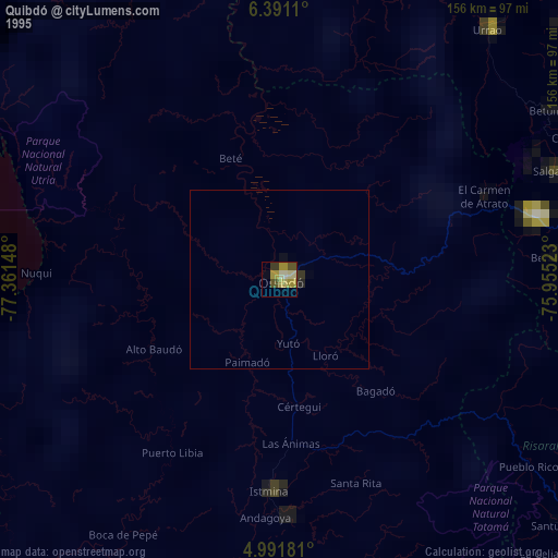
» NASA, Earths city lights 1995
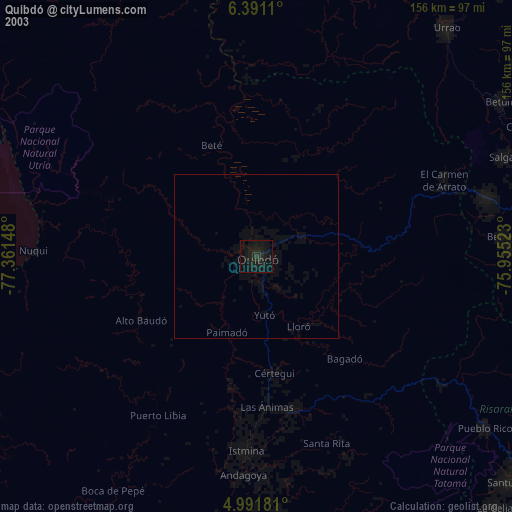
» NASA city lights 2003
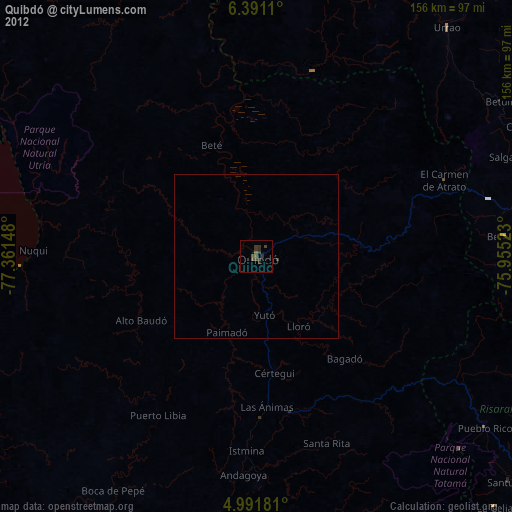
» Earth at Night: Flat Maps 2012, 2016