Padua night lights from space
Night Light of Padua (Tolima) from space (Colombia) Src. Average luminocity for 10x10km area is 0.5289% and for 50x50km: 2.1597%.
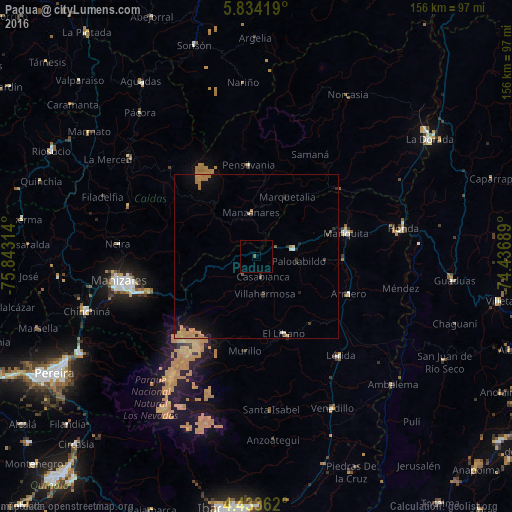
Analysis of Padua night lights 2016
Square area 10x10 km:
 0%
0%90-99
0%80-89
0%70-79
0%60-69
0%50-59
0.83%40-49
0%30-39
0%20-29
0%10-19
0%0-9
99.17%Square area 50x50 km:
0.06%90-99
0.06%80-89
0.22%70-79
1.08%60-69
0.38%50-59
0.17%40-49
0.13%30-39
0.15%20-29
0.39%10-19
1.56%0-9
95.8%Clear (daylight) street map image can be seen on geolist.org.
Map coordinates:
5° 50' 3.1" North, 75° 50' 35.3" West
5° 8' 3.4" North, 75° 8' 24" West
4° 26' 1" North, 74° 26' 12.8" West
Some cities around Padua sort by population:
• Líbano
25.1 km =15.6 mi,  159°
159°
• San Sebastián de Mariquita
28.3 km =17.6 mi,  75°
75°
• Fresno
11.7 km =7.3 mi, 79°
• Manzanares
13.4 km =8.3 mi,  353°
353°
• Pensilvania
27.8 km =17.3 mi,  355°
355°
• Marquetalia
20.4 km =12.7 mi,  27°
27°
• Guayabal
30.3 km =18.8 mi,  112°
112°
• Falan
20.9 km =13 mi,  93°
93°
3673404 (p: 19,311)
Sources (retrieved 2019-11-25):
» Earth at Night: Flat Maps 2012, 2016