Líbano night lights from space
Night Light of Líbano (Tolima) from space (Colombia) Src. Average luminocity for 10x10km area is 3.1901% and for 50x50km: 1.8814%.
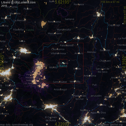
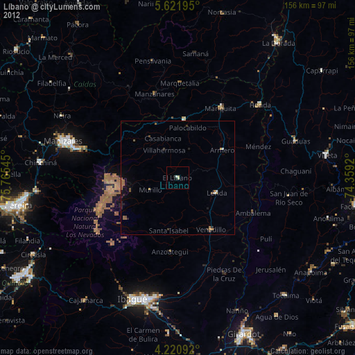
Analysis of Líbano night lights 2016
Square area 10x10 km:
 0.83%
0.83%90-99
0%80-89
0.83%70-79
0.83%60-69
0%50-59
0.83%40-49
0%30-39
0.41%20-29
0.41%10-19
0%0-9
95.87%Square area 50x50 km:
0.1%90-99
0.07%80-89
0.09%70-79
0.65%60-69
0.29%50-59
0.27%40-49
0.11%30-39
0.32%20-29
0.29%10-19
1.8%0-9
96%Clear (daylight) street map image can be seen on geolist.org.
Map coordinates:
5° 37' 19" North, 75° 45' 55.6" West
4° 55' 18.5" North, 75° 3' 44.4" West
4° 13' 15.3" North, 74° 21' 33.1" West
Some cities around Líbano sort by population:
• Lérida
18.1 km =11.2 mi,  111°
111°
• Padua
25.1 km =15.6 mi,  339°
339°
• Fresno
25.8 km =16 mi,  6°
6°
• Armero-Guyabal
18.4 km =11.4 mi,  74°
74°
• Venadillo
26.9 km =16.7 mi,  146°
146°
• Junín
16.2 km =10.1 mi,  161°
161°
• Guayabal
22.9 km =14.2 mi,  58°
58°
• Falan
25.6 km =15.9 mi,  28°
28°
3676604 (p: 28,211)
Sources (retrieved 2019-11-25):
» Earth at Night: Flat Maps 2012, 2016