Belén de Umbría night lights from space
Night Light of Belén de Umbría (Risaralda) from space (Colombia) Src. Average luminocity for 10x10km area is 1.5% and for 50x50km: 1.0677%.
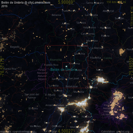
Analysis of Belén de Umbría night lights 2016
Square area 10x10 km:
 0.41%
0.41%90-99
0.41%80-89
0%70-79
0%60-69
0%50-59
0%40-49
0%30-39
0.41%20-29
1.03%10-19
0.21%0-9
97.52%Square area 50x50 km:
0.06%90-99
0.12%80-89
0.17%70-79
0.29%60-69
0.23%50-59
0.14%40-49
0.07%30-39
0.29%20-29
0.04%10-19
0.04%0-9
98.54%Clear (daylight) street map image can be seen on geolist.org.
Map coordinates:
5° 54' 2.5" North, 76° 34' 18.4" West
5° 12' 3.1" North, 75° 52' 7.1" West
4° 30' 1" North, 75° 9' 55.9" West
Some cities around Belén de Umbría sort by population:
• Anserma
17 km =10.6 mi,  30°
30°
• Viterbo
15.4 km =9.6 mi,  181°
181°
• Quinchía
21.7 km =13.5 mi,  44°
44°
• Apía
13.3 km =8.3 mi,  217°
217°
• Santuario
17.6 km =10.9 mi, 216°
• Belalcázar
23.7 km =14.7 mi,  164°
164°
• Mistrató
10.7 km =6.6 mi,  350°
350°
• Risaralda
12 km =7.5 mi,  108°
108°
3688989 (p: 15,698)
Sources (retrieved 2019-11-25):
» Earth at Night: Flat Maps 2012, 2016