Yuci night lights from space
Night Light of Yuci (Shanxi) from space (China) Src. Average luminocity for 10x10km area is 73.6922% and for 50x50km: 25.6589%.
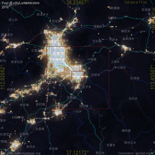
Analysis of Yuci night lights 2016
Square area 10x10 km:
 19.9%
19.9%90-99
24.83%80-89
7.99%70-79
10.03%60-69
8.16%50-59
4.42%40-49
8.16%30-39
5.78%20-29
8.84%10-19
1.87%0-9
0%Square area 50x50 km:
8.04%90-99
5.31%80-89
3.04%70-79
3.21%60-69
3.14%50-59
2.19%40-49
2.61%30-39
2.69%20-29
3.42%10-19
5.54%0-9
60.82%Clear (daylight) street map image can be seen on geolist.org.
Map coordinates:
38° 14' 4.8" North, 112° 1' 43.8" East
37° 40' 49" North, 112° 43' 55" East
37° 7' 18.2" North, 113° 26' 6.3" East
Some cities around Yuci sort by population:
• Taiyuan
25.9 km =16.1 mi,  324°
324°
• Shijiazhuang
158.5 km =98.5 mi,  75°
75°
• Yangquan
75.7 km =47 mi,  74°
74°
• Xinzhou
81 km =50.3 mi,  0°
0°
• Yuanping
115.1 km =71.5 mi, 1°
• Jiexiu
102.8 km =63.9 mi,  224°
224°
• Tianchang
118.1 km =73.4 mi, 72°
• Gutao
72.2 km =44.9 mi, 222°
1785974 (p: 235,929)
Sources (retrieved 2019-11-25):
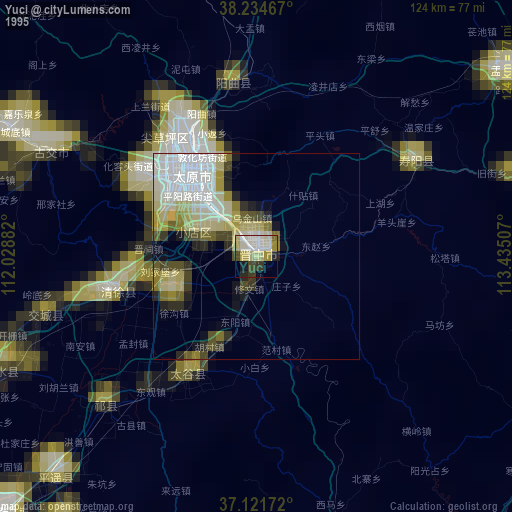
» NASA, Earths city lights 1995
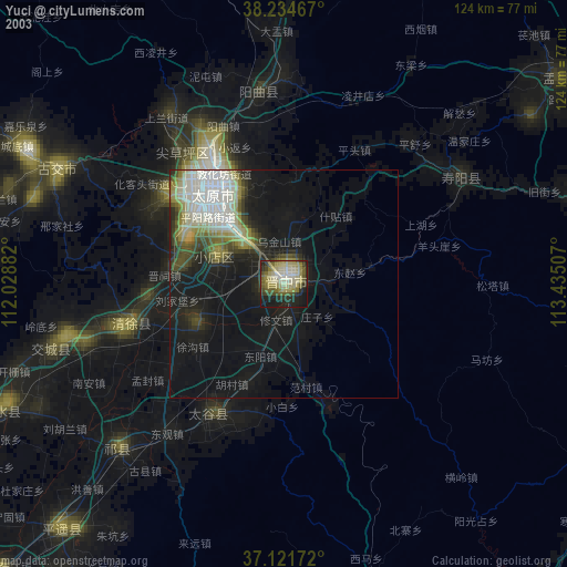
» NASA city lights 2003
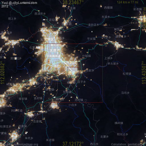
» Earth at Night: Flat Maps 2012, 2016