Yibin night lights from space
Night Light of Yibin (Sichuan) from space (China) Src. Average luminocity for 10x10km area is 67.9394% and for 50x50km: 9.6782%.
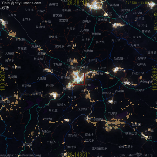
Analysis of Yibin night lights 2016
Square area 10x10 km:
 19.32%
90-99
19.7%80-89
3.98%70-79
4.17%60-69
9.09%50-59
12.88%40-49
11.93%30-39
4.55%20-29
10.8%10-19
3.6%0-9
0%Square area 50x50 km:
1.2%90-99
1.49%80-89
0.46%70-79
0.48%60-69
1.45%50-59
3.06%40-49
2.25%30-39
0.34%20-29
2%10-19
6.85%0-9
80.42%Clear (daylight) street map image can be seen on geolist.org.
Map coordinates:
29° 22' 52.3" North, 103° 55' 14.6" East
28° 46' 0" North, 104° 37' 25.8" East
28° 8' 54.6" North, 105° 19' 37.1" East
Some cities around Yibin sort by population:
• Zigong
65.6 km =40.8 mi,  13°
13°
• Neijiang
100.3 km =62.3 mi,  25°
25°
• Leshan
121.6 km =75.6 mi,  316°
316°
• Yongchuan
139.6 km =86.7 mi,  62°
62°
• Yanjiang
150.6 km =93.6 mi,  0°
0°
• Luocheng
89.8 km =55.8 mi, 319°
• Xunchang
35.9 km =22.3 mi,  165°
165°
• Chonglong
114.9 km =71.4 mi, 11°
1786770 (p: 242,111)
Sources (retrieved 2019-11-25):
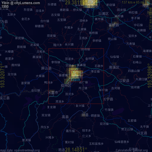
» NASA, Earths city lights 1995
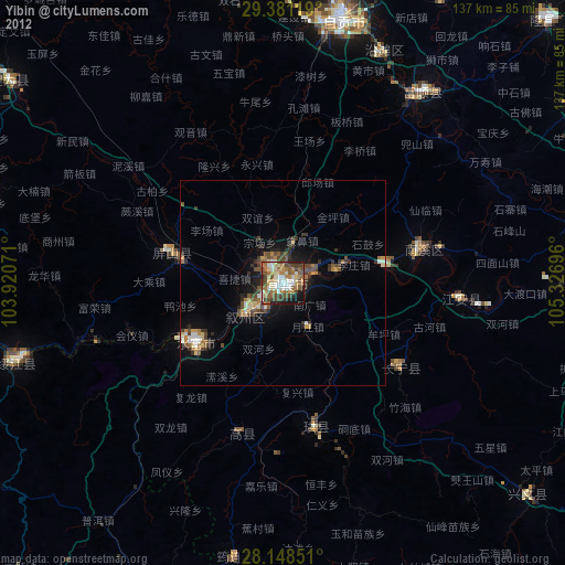
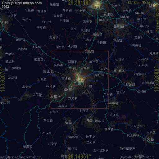
» NASA city lights 2003
» Earth at Night: Flat Maps 2012, 2016