Yangjiang night lights from space
Night Light of Yangjiang (Guangdong) from space (China) Src. Average luminocity for 10x10km area is 81.8968% and for 50x50km: 12.2884%.
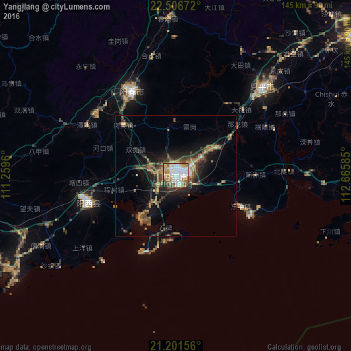


Analysis of Yangjiang night lights 2016
Square area 10x10 km:
 28.17%
90-99
23.61%80-89
8.73%70-79
12.5%60-69
8.33%50-59
8.73%40-49
7.14%30-39
1.19%20-29
1.59%10-19
0%0-9
0%Square area 50x50 km:
1.39%90-99
1.23%80-89
1.16%70-79
1.97%60-69
2.21%50-59
1.88%40-49
2.55%30-39
2.66%20-29
2.7%10-19
7.81%0-9
74.45%Clear (daylight) street map image can be seen on geolist.org.
Map coordinates:
22° 30' 24.2" North, 111° 15' 34.6" East
21° 51' 20.3" North, 111° 57' 45.8" East
21° 12' 5.6" North, 112° 39' 57.1" East
Some cities around Yangjiang sort by population:
• Yunfu
119.5 km =74.3 mi,  3°
3°
• Xinhui
130.2 km =80.9 mi,  59°
59°
• Gaozhou
115.6 km =71.8 mi,  274°
274°
• Yangchun
39.2 km =24.4 mi,  331°
331°
• Taishan
95 km =59 mi, 62°
• Encheng
50.9 km =31.6 mi,  43°
43°
• Xinyi
119.4 km =74.2 mi,  298°
298°
• Tangping
19.8 km =12.3 mi,  351°
351°
1806408 (p: 399,735)
Sources (retrieved 2019-11-25):
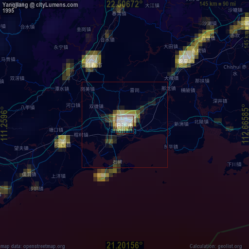
» NASA, Earths city lights 1995
» NASA city lights 2003
» Earth at Night: Flat Maps 2012, 2016