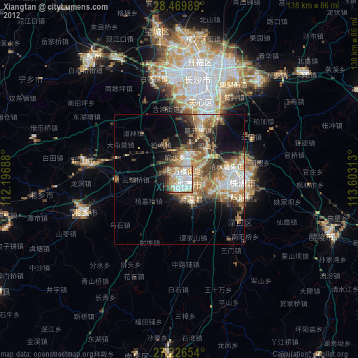
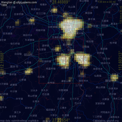
Xiangtan night lights from space
Night Light of Xiangtan (Hunan) from space (China) Src. Average luminocity for 10x10km area is 78.4394% and for 50x50km: 20.6271%.
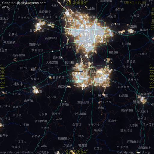

Analysis of Xiangtan night lights 2016
Square area 10x10 km:
 25.57%
90-99
26.14%80-89
7.01%70-79
8.9%60-69
6.82%50-59
9.09%40-49
7.01%30-39
2.27%20-29
5.3%10-19
1.89%0-9
0%Square area 50x50 km:
3.64%90-99
4.08%80-89
2.77%70-79
2.42%60-69
2.57%50-59
3.18%40-49
3.08%30-39
2.72%20-29
5.83%10-19
8.49%0-9
61.22%Clear (daylight) street map image can be seen on geolist.org.
Map coordinates:
28° 28' 11.6" North, 112° 11' 48.8" East
27° 51' 0" North, 112° 54' 0" East
27° 13' 35.5" North, 113° 36' 11.3" East
Some cities around Xiangtan sort by population:
• Changsha
39.4 km =24.5 mi,  10°
10°
• Guankou
79.2 km =49.2 mi,  64°
64°
• Zhuzhou
24.6 km =15.3 mi,  94°
94°
• Loudi
90 km =55.9 mi,  261°
261°
• Xishan
62.5 km =38.8 mi,  109°
109°
• Yongfeng
84.7 km =52.6 mi,  236°
236°
• Wenxing
92.5 km =57.5 mi,  358°
358°
• Yutan
56.3 km =35 mi,  323°
323°
1790492 (p: 674,189)
Sources (retrieved 2019-11-25):
» NASA, Earths city lights 1995
» NASA city lights 2003
» Earth at Night: Flat Maps 2012, 2016