Guankou night lights from space
Night Light of Guankou (Hunan) from space (China) Src. Average luminocity for 10x10km area is 15.9621% and for 50x50km: 1.3728%.
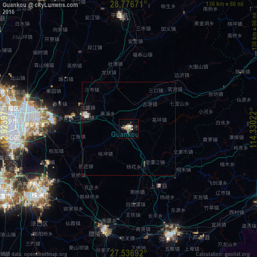
Analysis of Guankou night lights 2016
Square area 10x10 km:
 0%
0%90-99
3.03%80-89
1.52%70-79
1.33%60-69
6.06%50-59
2.27%40-49
3.22%30-39
1.14%20-29
1.89%10-19
1.14%0-9
78.41%Square area 50x50 km:
0.16%90-99
0.31%80-89
0.09%70-79
0.08%60-69
0.32%50-59
0.14%40-49
0.2%30-39
0.08%20-29
0.12%10-19
0.45%0-9
98.05%Clear (daylight) street map image can be seen on geolist.org.
Map coordinates:
28° 46' 36.2" North, 112° 55' 26.3" East
28° 9' 31" North, 113° 37' 37.5" East
27° 32' 12.9" North, 114° 19' 48.8" East
Some cities around Guankou sort by population:
• Changsha
64.5 km =40.1 mi,  273°
273°
• Zhuzhou
59.2 km =36.8 mi,  232°
232°
• Xiangtan
79.2 km =49.2 mi,  244°
244°
• Pingxiang
64.2 km =39.9 mi,  159°
159°
• Yichun
84.1 km =52.3 mi,  115°
115°
• Xishan
56.1 km =34.9 mi,  192°
192°
• Wenxing
93.5 km =58.1 mi,  308°
308°
• Yutan
105.1 km =65.3 mi,  276°
276°
1802875 (p: 1,380,000)
Sources (retrieved 2019-11-25):
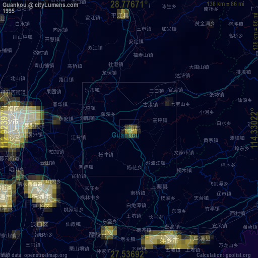
» NASA, Earths city lights 1995
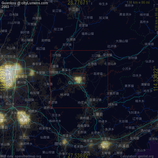
» NASA city lights 2003
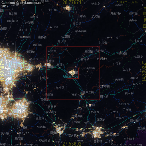
» Earth at Night: Flat Maps 2012, 2016