Tongzhou night lights from space
Night Light of Tongzhou (Beijing) from space (China) Src. Average luminocity for 10x10km area is 95.8469% and for 50x50km: 68.4979%.
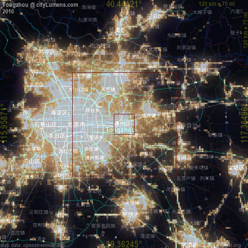
Analysis of Tongzhou night lights 2016
Square area 10x10 km:
 57.31%
90-99
26.19%80-89
8.33%70-79
7.31%60-69
0.85%50-59
0%40-49
0%30-39
0%20-29
0%10-19
0%0-9
0%Square area 50x50 km:
22.07%90-99
12.63%80-89
10.51%70-79
10.08%60-69
8.93%50-59
8.2%40-49
7.03%30-39
4.83%20-29
6.62%10-19
7.41%0-9
1.69%Clear (daylight) street map image can be seen on geolist.org.
Map coordinates:
40° 26' 28.4" North, 115° 57' 31.4" East
39° 54' 14.2" North, 116° 39' 42.6" East
39° 21' 44.8" North, 117° 21' 53.9" East
Some cities around Tongzhou sort by population:
• Beijing
22.6 km =14 mi,  271°
271°
• Langfang
43.9 km =27.3 mi,  176°
176°
• Mentougou
48.6 km =30.2 mi, 274°
• Shunyi
24.2 km =15 mi,  357°
357°
• Daxing
33.9 km =21.1 mi,  237°
237°
• Changping
50.3 km =31.3 mi,  313°
313°
• Liangxiang
48.9 km =30.4 mi,  247°
247°
• Bangjun
52.1 km =32.4 mi,  79°
79°
1792520 (p: 163,326)
Sources (retrieved 2019-11-25):
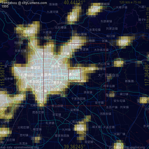
» NASA, Earths city lights 1995
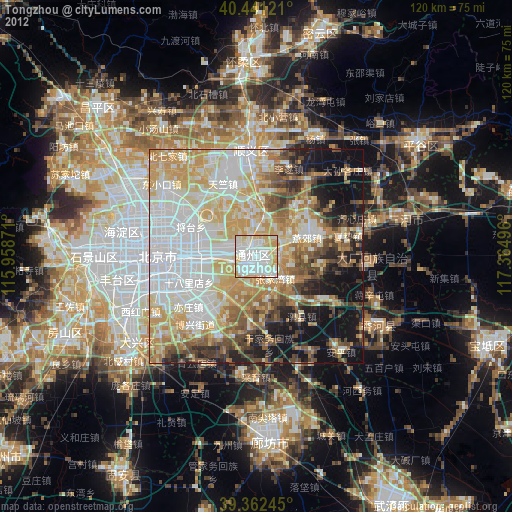
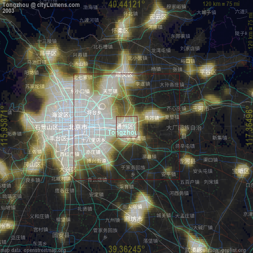
» NASA city lights 2003
» Earth at Night: Flat Maps 2012, 2016