Tongliao night lights from space
Night Light of Tongliao (Inner Mongolia) from space (China) Src. Average luminocity for 10x10km area is 69.503% and for 50x50km: 5.5728%.
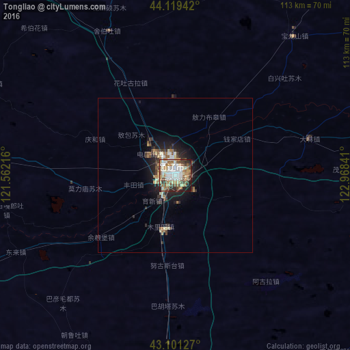
Analysis of Tongliao night lights 2016
Square area 10x10 km:
 15.15%
90-99
19.7%80-89
10.15%70-79
7.27%60-69
11.52%50-59
8.48%40-49
11.82%30-39
5.76%20-29
6.36%10-19
3.79%0-9
0%Square area 50x50 km:
0.72%90-99
1.15%80-89
0.66%70-79
0.46%60-69
0.93%50-59
0.66%40-49
0.91%30-39
0.97%20-29
1.38%10-19
3.44%0-9
88.72%Clear (daylight) street map image can be seen on geolist.org.
Map coordinates:
44° 7' 9.9" North, 121° 33' 43.8" East
43° 36' 45" North, 122° 15' 55" East
43° 6' 4.6" North, 122° 58' 6.3" East
Some cities around Tongliao sort by population:
• Fuxin
184.3 km =114.5 mi,  195°
195°
• Siping
177.9 km =110.5 mi,  106°
106°
• Zhengjiatun
100.7 km =62.6 mi,  96°
96°
• Xinmin
186 km =115.6 mi,  165°
165°
• Changtu
174.9 km =108.7 mi,  121°
121°
• Kaitong
148.1 km =92 mi,  26°
26°
• Lishu
169.9 km =105.6 mi, 101°
• Changling
156.7 km =97.4 mi,  62°
62°
2034400 (p: 261,110)
Sources (retrieved 2019-11-25):
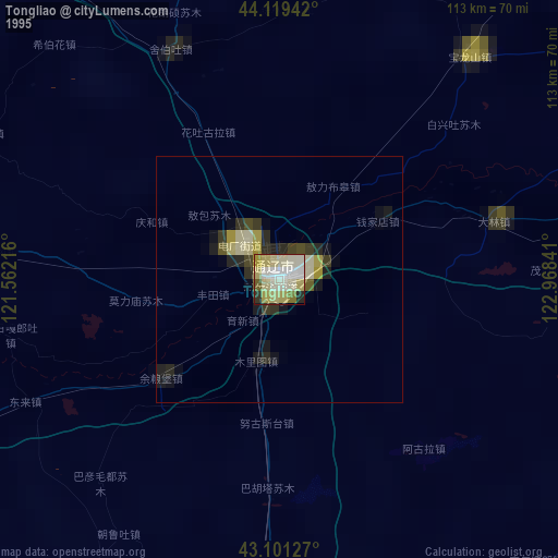
» NASA, Earths city lights 1995
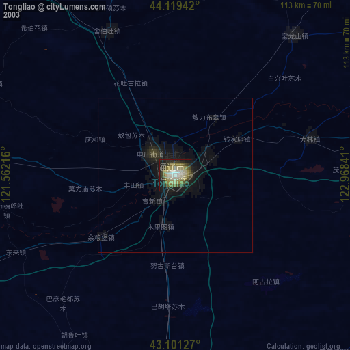
» NASA city lights 2003
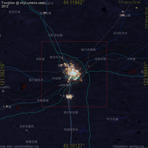
» Earth at Night: Flat Maps 2012, 2016