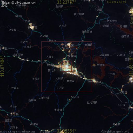
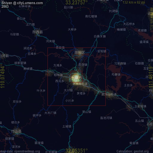
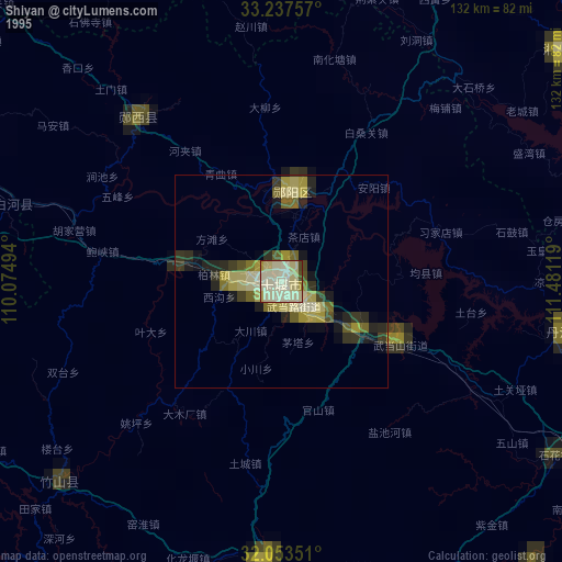
Shiyan night lights from space
Night Light of Shiyan (Hubei) from space (China) Src. Average luminocity for 10x10km area is 62.8951% and for 50x50km: 6.657%.
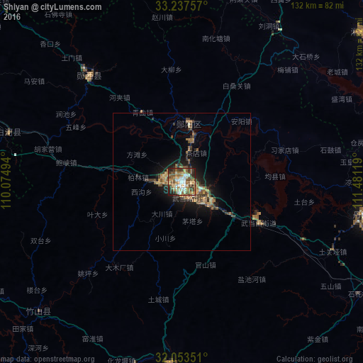
Analysis of Shiyan night lights 2016
Square area 10x10 km:
 8.57%
8.57%90-99
13.11%80-89
8.57%70-79
10.49%60-69
10.49%50-59
15.91%40-49
12.76%30-39
8.39%20-29
9.27%10-19
2.45%0-9
0%Square area 50x50 km:
0.35%90-99
0.69%80-89
0.74%70-79
1.09%60-69
1.16%50-59
1.49%40-49
1.37%30-39
1.37%20-29
1.4%10-19
4.44%0-9
85.88%Clear (daylight) street map image can be seen on geolist.org.
Map coordinates:
33° 14' 15.3" North, 110° 4' 29.8" East
32° 38' 51" North, 110° 46' 41" East
32° 3' 12.6" North, 111° 28' 52.3" East
Some cities around Shiyan sort by population:
• Xiangyang
145 km =90.1 mi,  117°
117°
• Laohekou
88.3 km =54.9 mi,  109°
109°
• Ankang
164.9 km =102.5 mi,  271°
271°
• Danjiangkou
69.4 km =43.1 mi,  99°
99°
• Nanzhang Chengguanzhen
137.7 km =85.6 mi,  134°
134°
• Gucheng Chengguanzhen
90.9 km =56.5 mi, 117°
• Hancheng
148.2 km =92.1 mi, 95°
• Huazhou
122.1 km =75.9 mi,  88°
88°
1794903 (p: 3,460,000)
Sources (retrieved 2019-11-25):
» NASA, Earths city lights 1995
» NASA city lights 2003
» Earth at Night: Flat Maps 2012, 2016