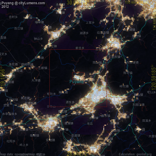
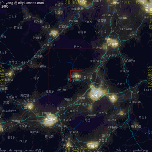
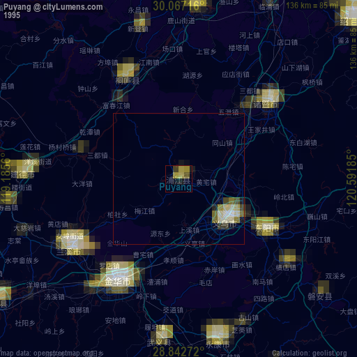
Puyang night lights from space
Night Light of Puyang (Zhejiang) from space (China) Src. Average luminocity for 10x10km area is 48.3011% and for 50x50km: 19.0906%.
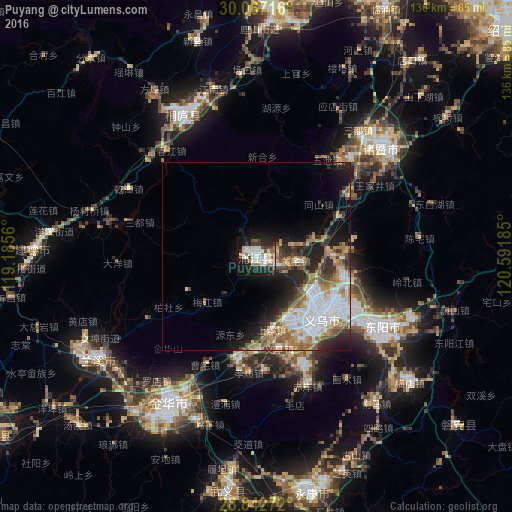
Analysis of Puyang night lights 2016
Square area 10x10 km:
 9.66%
9.66%90-99
12.88%80-89
8.52%70-79
3.22%60-69
3.22%50-59
3.41%40-49
4.73%30-39
6.44%20-29
16.67%10-19
27.46%0-9
3.79%Square area 50x50 km:
4.53%90-99
3.43%80-89
1.73%70-79
2.41%60-69
3.13%50-59
2.45%40-49
2.19%30-39
2.52%20-29
4.53%10-19
7.97%0-9
65.11%Clear (daylight) street map image can be seen on geolist.org.
Map coordinates:
30° 4' 1.8" North, 119° 11' 8.2" East
29° 27' 24.4" North, 119° 53' 19.4" East
28° 50' 33.8" North, 120° 35' 30.7" East
Some cities around Puyang sort by population:
• Guli
65.5 km =40.7 mi,  167°
167°
• Jinhua
45.6 km =28.3 mi,  211°
211°
• Dongyang
38.8 km =24.1 mi,  122°
122°
• Zhuji
44.9 km =27.9 mi,  49°
49°
• Xiaoshan
86.7 km =53.9 mi,  24°
24°
• Yiwu
24.1 km =15 mi,  130°
130°
• Lanxi
48.5 km =30.1 mi,  236°
236°
• Fuyang
66.6 km =41.4 mi,  5°
5°
1798425 (p: 3,590,000)
Sources (retrieved 2019-11-25):
» NASA, Earths city lights 1995
» NASA city lights 2003
» Earth at Night: Flat Maps 2012, 2016