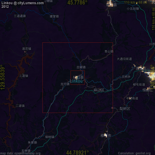
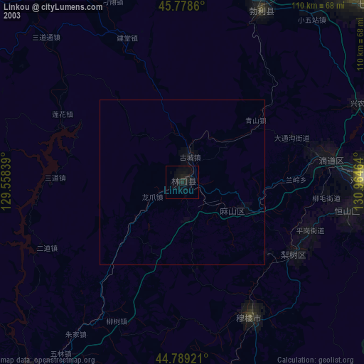
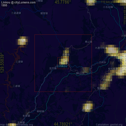
Linkou night lights from space
Night Light of Linkou (Heilongjiang) from space (China) Src. Average luminocity for 10x10km area is 4.6381% and for 50x50km: 0.1938%.
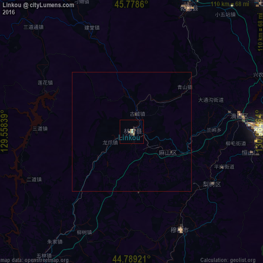
Analysis of Linkou night lights 2016
Square area 10x10 km:
 0%
0%90-99
1.27%80-89
0%70-79
0.63%60-69
0.48%50-59
1.43%40-49
1.27%30-39
0.95%20-29
1.59%10-19
0%0-9
92.38%Square area 50x50 km:
0%90-99
0.05%80-89
0%70-79
0.02%60-69
0.02%50-59
0.05%40-49
0.05%30-39
0.04%20-29
0.11%10-19
0%0-9
99.66%Clear (daylight) street map image can be seen on geolist.org.
Map coordinates:
45° 46' 43" North, 129° 33' 30.2" East
45° 17' 9.8" North, 130° 15' 41.4" East
44° 47' 21.2" North, 130° 57' 52.7" East
Some cities around Linkou sort by population:
• Jixi
54.4 km =33.8 mi,  88°
88°
• Taihecun
70.2 km =43.6 mi,  40°
40°
• Fendou
50.8 km =31.6 mi,  99°
99°
• Dongxing
41.9 km =26 mi,  78°
78°
• Chengzihe
63.2 km =39.3 mi, 85°
• Boli
57.3 km =35.6 mi,  24°
24°
• Bamiantong
45.7 km =28.4 mi,  153°
153°
• Jidong
64.8 km =40.3 mi, 96°
2036066 (p: 77,754)
Sources (retrieved 2019-11-25):
» NASA, Earths city lights 1995
» NASA city lights 2003
» Earth at Night: Flat Maps 2012, 2016