Jixi night lights from space
Night Light of Jixi (Heilongjiang) from space (China) Src. Average luminocity for 10x10km area is 44.1254% and for 50x50km: 2.8288%.
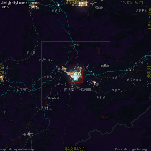
Analysis of Jixi night lights 2016
Square area 10x10 km:
 7.78%
7.78%90-99
10.48%80-89
3.02%70-79
4.29%60-69
4.6%50-59
8.41%40-49
5.71%30-39
6.67%20-29
13.33%10-19
33.33%0-9
2.38%Square area 50x50 km:
0.3%90-99
0.42%80-89
0.13%70-79
0.36%60-69
0.29%50-59
0.47%40-49
0.56%30-39
0.53%20-29
0.89%10-19
2.41%0-9
93.63%Clear (daylight) street map image can be seen on geolist.org.
Map coordinates:
45° 47' 36.6" North, 130° 15' 14.6" East
45° 18' 3.9" North, 130° 57' 25.8" East
44° 48' 15.7" North, 131° 39' 37.1" East
Some cities around Jixi sort by population:
• Taihecun
52.1 km =32.4 mi,  350°
350°
• Fendou
10.8 km =6.7 mi,  203°
203°
• Dongxing
14.9 km =9.3 mi,  296°
296°
• Chengzihe
9.3 km =5.8 mi,  67°
67°
• Boli
58.5 km =36.4 mi,  329°
329°
• Linkou
54.4 km =33.8 mi,  268°
268°
• Bamiantong
54.7 km =34 mi,  218°
218°
• Jidong
13.6 km =8.5 mi,  133°
133°
2036389 (p: 403,759)
Sources (retrieved 2019-11-25):
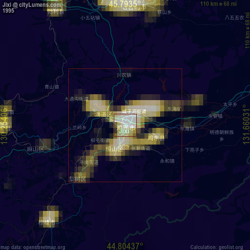
» NASA, Earths city lights 1995
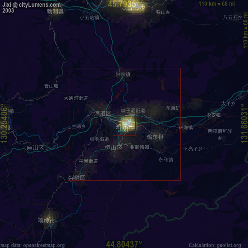
» NASA city lights 2003
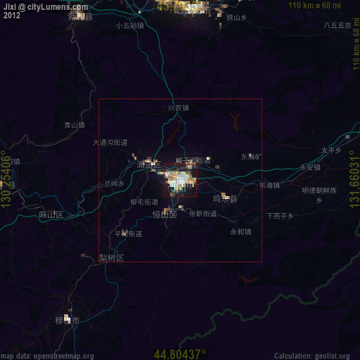
» Earth at Night: Flat Maps 2012, 2016