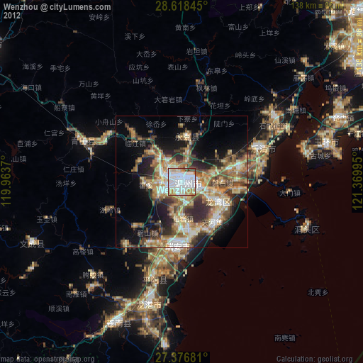
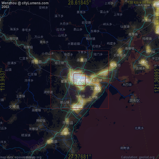
Wenzhou night lights from space
Night Light of Wenzhou (Zhejiang) from space (China) Src. Average luminocity for 10x10km area is 93.0398% and for 50x50km: 36.107%.
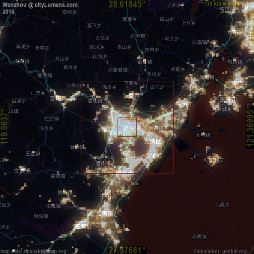

Analysis of Wenzhou night lights 2016
Square area 10x10 km:
 41.48%
90-99
35.61%80-89
5.11%70-79
10.23%60-69
6.44%50-59
0.38%40-49
0.76%30-39
0%20-29
0%10-19
0%0-9
0%Square area 50x50 km:
7.72%90-99
7.79%80-89
3.38%70-79
3.7%60-69
4.11%50-59
6.03%40-49
6.25%30-39
6.32%20-29
7.51%10-19
11.14%0-9
36.04%Clear (daylight) street map image can be seen on geolist.org.
Map coordinates:
28° 37' 6.4" North, 119° 57' 49.3" East
27° 59' 57.9" North, 120° 40' 0.6" East
27° 22' 36.5" North, 121° 22' 11.8" East
Some cities around Wenzhou sort by population:
• Luqiao
94.7 km =58.8 mi,  47°
47°
• Huangyan
93.1 km =57.8 mi,  39°
39°
• Lishui
90.1 km =56 mi,  304°
304°
• Jinxiang
63.3 km =39.3 mi,  185°
185°
• Wenling
81.8 km =50.8 mi,  59°
59°
• Kunyang
38.4 km =23.9 mi, 194°
• Fuding
87 km =54.1 mi,  210°
210°
• Xianju
95.3 km =59.2 mi,  3°
3°
1791388 (p: 865,672)
Sources (retrieved 2019-11-25):
» NASA, Earths city lights 1995
» NASA city lights 2003
» Earth at Night: Flat Maps 2012, 2016