Huanggang night lights from space
Night Light of Huanggang (Guangdong) from space (China) Src. Average luminocity for 10x10km area is 41.5119% and for 50x50km: 12.9766%.
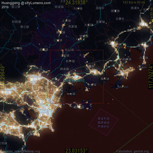
Analysis of Huanggang night lights 2016
Square area 10x10 km:
 4.96%
4.96%90-99
6.75%80-89
2.18%70-79
11.51%60-69
5.95%50-59
4.37%40-49
4.17%30-39
9.33%20-29
12.7%10-19
33.93%0-9
4.17%Square area 50x50 km:
0.77%90-99
1.14%80-89
0.63%70-79
3.43%60-69
2.22%50-59
2.93%40-49
2.24%30-39
2.2%20-29
3.58%10-19
10%0-9
70.86%Clear (daylight) street map image can be seen on geolist.org.
Map coordinates:
24° 19' 9.8" North, 116° 17' 47.4" East
23° 40' 37.3" North, 116° 59' 58.6" East
23° 1' 53.5" North, 117° 42' 9.9" East
Some cities around Huanggang sort by population:
• Shantou
45 km =28 mi,  220°
220°
• Jieyang
66.3 km =41.2 mi,  256°
256°
• Chaozhou
38.5 km =23.9 mi,  266°
266°
• Anbu
41.2 km =25.6 mi,  232°
232°
• Chenghua
33.5 km =20.8 mi, 224°
• Huicheng
101.4 km =63 mi, 225°
• Haimen
66.7 km =41.4 mi, 216°
• Puning
94 km =58.4 mi,  244°
244°
1807508 (p: 225,956)
Sources (retrieved 2019-11-25):
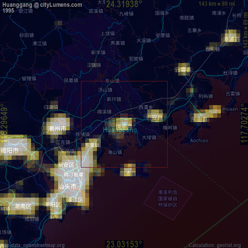
» NASA, Earths city lights 1995
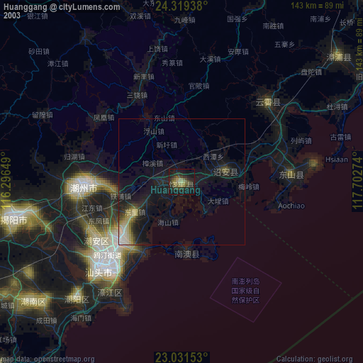
» NASA city lights 2003
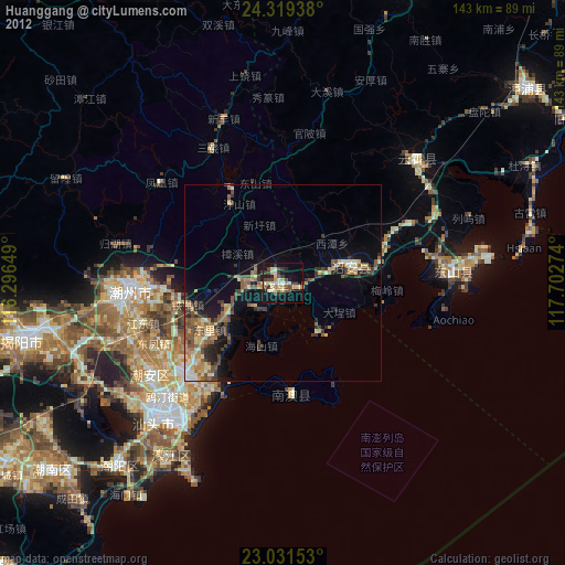
» Earth at Night: Flat Maps 2012, 2016