Haimen night lights from space
Night Light of Haimen (Guangdong) from space (China) Src. Average luminocity for 10x10km area is 35.1004% and for 50x50km: 25.7537%.
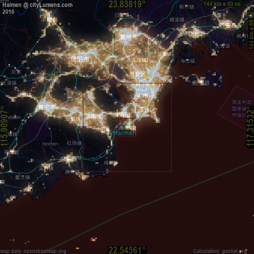
Analysis of Haimen night lights 2016
Square area 10x10 km:
 3.22%
3.22%90-99
3.6%80-89
3.79%70-79
5.68%60-69
3.03%50-59
9.28%40-49
7.01%30-39
10.8%20-29
13.26%10-19
19.51%0-9
20.83%Square area 50x50 km:
4.59%90-99
4.02%80-89
2.43%70-79
3.73%60-69
5.34%50-59
4.72%40-49
3.08%30-39
3.25%20-29
7.02%10-19
11.02%0-9
50.8%Clear (daylight) street map image can be seen on geolist.org.
Map coordinates:
23° 50' 17.5" North, 115° 54' 32.7" East
23° 11' 36.5" North, 116° 36' 43.9" East
22° 32' 44.2" North, 117° 18' 55.2" East
Some cities around Haimen sort by population:
• Shantou
22.1 km =13.7 mi,  28°
28°
• Jieyang
46.2 km =28.7 mi,  327°
327°
• Chaozhou
51.2 km =31.8 mi,  1°
1°
• Anbu
29.3 km =18.2 mi,  13°
13°
• Chenghua
33.9 km =21.1 mi, 28°
• Jiazi
65.3 km =40.6 mi,  237°
237°
• Huicheng
37.2 km =23.1 mi, 242°
• Puning
47.1 km =29.3 mi,  286°
286°
1809062 (p: 125,427)
Sources (retrieved 2019-11-25):
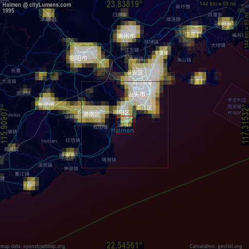
» NASA, Earths city lights 1995
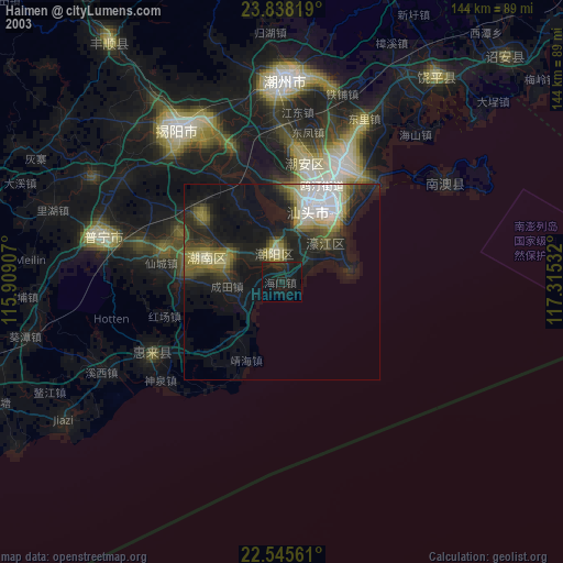
» NASA city lights 2003
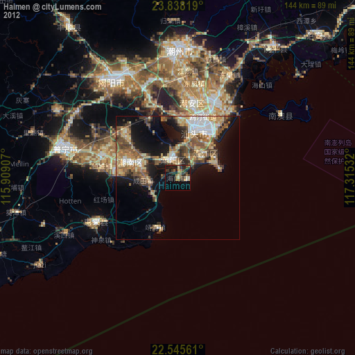
» Earth at Night: Flat Maps 2012, 2016