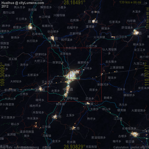
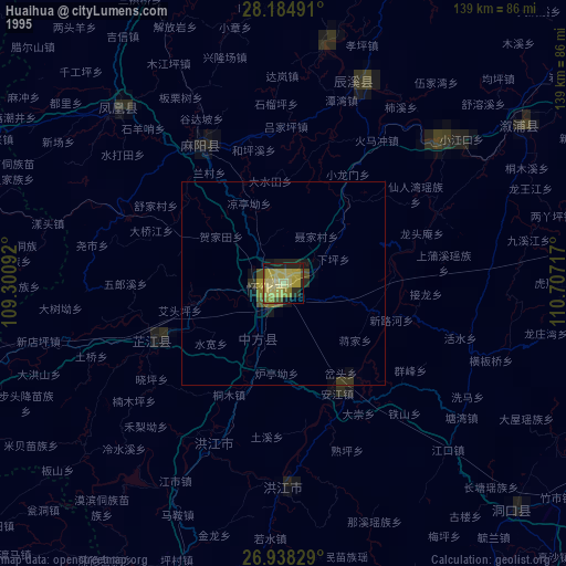
Huaihua night lights from space
Night Light of Huaihua (Hunan) from space (China) Src. Average luminocity for 10x10km area is 46.4544% and for 50x50km: 3.8327%.


Analysis of Huaihua night lights 2016
Square area 10x10 km:
 6.55%
6.55%90-99
11.9%80-89
6.75%70-79
4.37%60-69
6.94%50-59
7.54%40-49
5.56%30-39
6.35%20-29
9.33%10-19
23.02%0-9
11.71%Square area 50x50 km:
0.51%90-99
0.78%80-89
0.41%70-79
0.21%60-69
0.4%50-59
0.68%40-49
0.51%30-39
0.47%20-29
0.74%10-19
3.26%0-9
92.03%Clear (daylight) street map image can be seen on geolist.org.
Map coordinates:
28° 11' 5.7" North, 109° 18' 3.3" East
27° 33' 48.1" North, 110° 0' 14.5" East
26° 56' 17.8" North, 110° 42' 25.8" East
Some cities around Huaihua sort by population:
• Fenghuang
57.4 km =35.7 mi,  316°
316°
• Qianzhou
88.1 km =54.7 mi,  342°
342°
• Tongren
82.4 km =51.2 mi,  281°
281°
• Hongjiang
50.4 km =31.3 mi,  180°
180°
• Anjiang
28.8 km =17.9 mi,  160°
160°
• Qiancheng
48.2 km =30 mi,  209°
209°
• Liuduzhai
94.4 km =58.7 mi,  103°
103°
• Simenqian
87.4 km =54.3 mi, 95°
1807689 (p: 127,322)
Sources (retrieved 2019-11-25):
» NASA, Earths city lights 1995
» NASA city lights 2003
» Earth at Night: Flat Maps 2012, 2016