Fenghuang night lights from space
Night Light of Fenghuang (Hunan) from space (China) Src. Average luminocity for 10x10km area is 7.9716% and for 50x50km: 1.1462%.
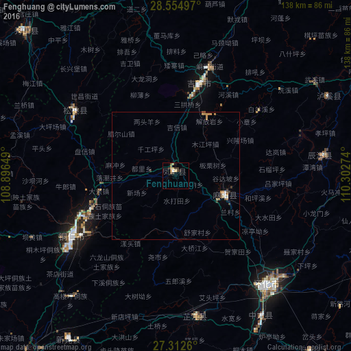
Analysis of Fenghuang night lights 2016
Square area 10x10 km:
 0.57%
0.57%90-99
0.19%80-89
3.03%70-79
0.19%60-69
1.33%50-59
1.52%40-49
1.7%30-39
2.08%20-29
0.76%10-19
0.76%0-9
87.88%Square area 50x50 km:
0.1%90-99
0.08%80-89
0.18%70-79
0.33%60-69
0.16%50-59
0.09%40-49
0.2%30-39
0.22%20-29
0.03%10-19
0.11%0-9
98.49%Clear (daylight) street map image can be seen on geolist.org.
Map coordinates:
28° 33' 17.9" North, 108° 53' 47.4" East
27° 56' 8.1" North, 109° 35' 58.6" East
27° 18' 45.4" North, 110° 18' 9.9" East
Some cities around Fenghuang sort by population:
• Huaihua
57.4 km =35.7 mi,  136°
136°
• Qianzhou
44.6 km =27.7 mi,  17°
17°
• Tongren
47.4 km =29.5 mi,  239°
239°
• Hongjiang
99.8 km =62 mi,  156°
156°
• Anjiang
84.6 km =52.6 mi, 144°
• Shiqian
142.6 km =88.6 mi,  251°
251°
• Qiancheng
85 km =52.8 mi,  168°
168°
• Simenqian
136.1 km =84.6 mi,  111°
111°
7304020 (p: 370,000)
Sources (retrieved 2019-11-25):
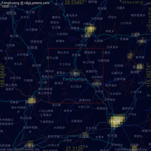
» NASA, Earths city lights 1995
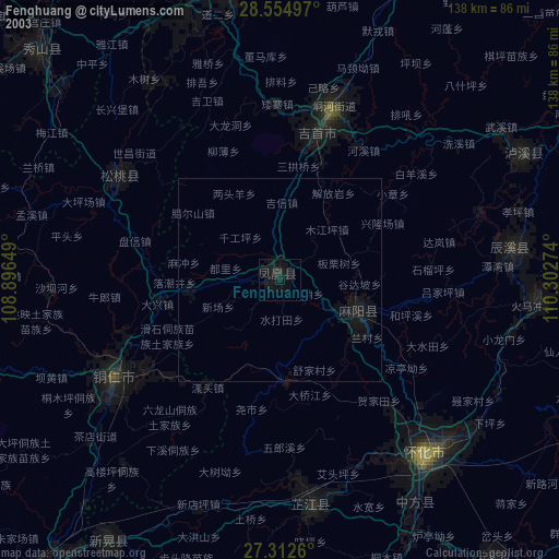
» NASA city lights 2003
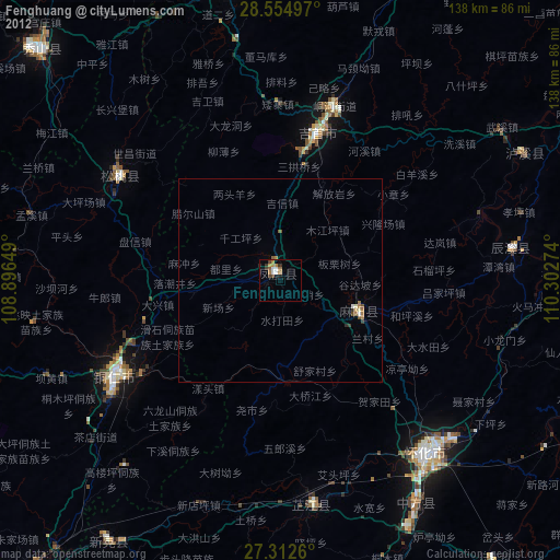
» Earth at Night: Flat Maps 2012, 2016