Zürich (Kreis 2) night lights from space
Night Light of Zürich (Kreis 2) (Zurich) from space (Switzerland) Src. Average luminocity for 10x10km area is 52.5818% and for 50x50km: 18.4541%.
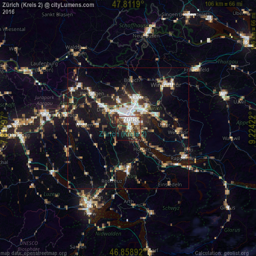
Analysis of Zürich (Kreis 2) night lights 2016
Square area 10x10 km:
 14.29%
90-99
11.76%80-89
2.98%70-79
3.27%60-69
7.74%50-59
4.91%40-49
11.16%30-39
10.71%20-29
12.65%10-19
15.92%0-9
4.61%Square area 50x50 km:
2.74%90-99
2.87%80-89
1.27%70-79
1.65%60-69
2.58%50-59
2.38%40-49
2.96%30-39
3.03%20-29
4.58%10-19
16.93%0-9
59.01%Clear (daylight) street map image can be seen on geolist.org.
Map coordinates:
47° 48' 42.8" North, 7° 49' 4.7" East
47° 20' 15.2" North, 8° 31' 16" East
46° 51' 32.1" North, 9° 13' 27.2" East
Some cities around Zürich (Kreis 2) sort by population:
• Zürich
3.9 km =2.4 mi,  33°
33°
• Adliswil
3.1 km =1.9 mi,  175°
175°
• Thalwil
6 km =3.7 mi,  147°
147°
• Küsnacht
5.2 km =3.2 mi,  114°
114°
• Langnau am Albis
5.6 km =3.5 mi,  164°
164°
• Thalwil / Dorfkern
6.2 km =3.9 mi, 146°
• Kilchberg
2.4 km =1.5 mi,  128°
128°
• Zollikon
4 km =2.5 mi,  85°
85°
6295540 (p: 29,215)
Sources (retrieved 2019-11-25):
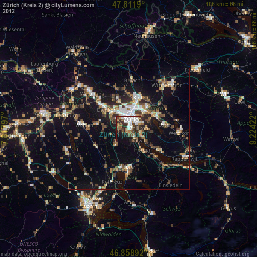
» Earth at Night: Flat Maps 2012, 2016