Bülach night lights from space
Night Light of Bülach (Zurich) from space (Switzerland) Src. Average luminocity for 10x10km area is 8.6122% and for 50x50km: 15.7623%.
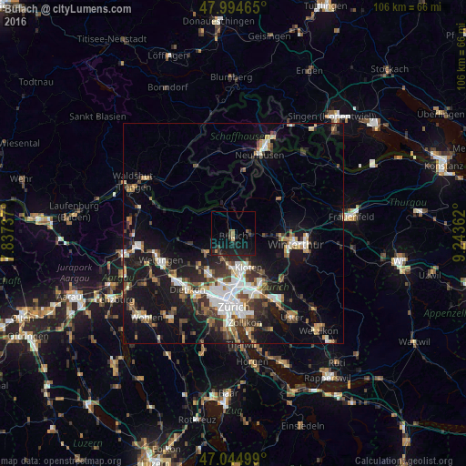
Analysis of Bülach night lights 2016
Square area 10x10 km:
 0%
0%90-99
0%80-89
0.57%70-79
0.57%60-69
1.14%50-59
0.57%40-49
1.7%30-39
1.7%20-29
5.4%10-19
17.76%0-9
70.6%Square area 50x50 km:
2.61%90-99
2.77%80-89
1.28%70-79
1.34%60-69
2.02%50-59
1.67%40-49
2.55%30-39
2.67%20-29
4.11%10-19
13.87%0-9
65.1%Clear (daylight) street map image can be seen on geolist.org.
Map coordinates:
47° 59' 40.7" North, 7° 50' 14.5" East
47° 31' 19.1" North, 8° 32' 25.8" East
47° 2' 42" North, 9° 14' 37" East
Some cities around Bülach sort by population:
• Zürich (Kreis 11)
11.1 km =6.9 mi,  187°
187°
• Zürich (Kreis 11) / Seebach
11.2 km =7 mi,  177°
177°
• Kloten
8.5 km =5.3 mi,  156°
156°
• Wülflingen (Kreis 6)
10.8 km =6.7 mi,  96°
96°
• Regensdorf
11.2 km =7 mi,  208°
208°
• Embrach
4.4 km =2.7 mi,  114°
114°
• Bassersdorf
11 km =6.8 mi,  142°
142°
• Rümlang
8 km =5 mi, 185°
2661338 (p: 13,172)
Sources (retrieved 2019-11-25):
» Earth at Night: Flat Maps 2012, 2016