Aarburg night lights from space
Night Light of Aarburg (Aargau) from space (Switzerland) Src. Average luminocity for 10x10km area is 44.4092% and for 50x50km: 14.9278%.
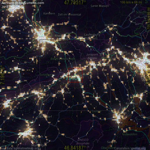
Analysis of Aarburg night lights 2016
Square area 10x10 km:
 5.51%
5.51%90-99
10.71%80-89
4.32%70-79
5.65%60-69
7.14%50-59
4.32%40-49
4.02%30-39
5.65%20-29
26.64%10-19
26.04%0-9
0%Square area 50x50 km:
1.35%90-99
2.08%80-89
1.08%70-79
1.71%60-69
2.22%50-59
2.35%40-49
2.12%30-39
2.45%20-29
4.22%10-19
14.48%0-9
65.95%Clear (daylight) street map image can be seen on geolist.org.
Map coordinates:
47° 47' 42.6" North, 7° 11' 48.2" East
47° 19' 14.4" North, 7° 53' 59.5" East
46° 50' 30.7" North, 8° 36' 10.7" East
Some cities around Aarburg sort by population:
• Olten
3.3 km =2.1 mi,  4°
4°
• Aarau
13.5 km =8.4 mi,  53°
53°
• Langenthal
14.1 km =8.8 mi,  213°
213°
• Zofingen
5 km =3.1 mi,  136°
136°
• Oftringen
2.1 km =1.3 mi,  111°
111°
• Oberentfelden
11.7 km =7.3 mi,  70°
70°
• Rothrist
1.8 km =1.1 mi,  198°
198°
• Trimbach
5.1 km =3.2 mi,  348°
348°
2661879 (p: 6,828)
Sources (retrieved 2019-11-25):
» Earth at Night: Flat Maps 2012, 2016