Vaudreuil-Dorion night lights from space
Night Light of Vaudreuil-Dorion (Quebec) from space (Canada) Src. Average luminocity for 10x10km area is 51.4714% and for 50x50km: 27.7829%.
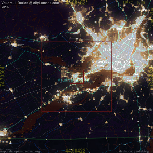
Analysis of Vaudreuil-Dorion night lights 2016
Square area 10x10 km:
 10.79%
90-99
11.75%80-89
6.35%70-79
3.81%60-69
9.05%50-59
2.86%40-49
3.33%30-39
11.11%20-29
23.97%10-19
16.98%0-9
0%Square area 50x50 km:
6.59%90-99
5.81%80-89
2.91%70-79
3.32%60-69
2.75%50-59
2.12%40-49
3.22%30-39
4.58%20-29
7.38%10-19
13.27%0-9
48.05%Clear (daylight) street map image can be seen on geolist.org.
Map coordinates:
45° 53' 29.8" North, 74° 44' 8.3" West
45° 24' 0.3" North, 74° 1' 57" West
44° 54' 15.2" North, 73° 19' 45.8" West
Some cities around Vaudreuil-Dorion sort by population:
• Beaconsfield
13.5 km =8.4 mi,  74°
74°
• Saint-Lazare
7.8 km =4.8 mi,  270°
270°
• Pincourt
4.3 km =2.7 mi,  115°
115°
• L'Île-Perrot
6.8 km =4.2 mi,  105°
105°
• Notre-Dame-de-l'Île-Perrot
8.6 km =5.3 mi, 115°
• Pointe-Calumet
12.3 km =7.6 mi,  25°
25°
• Sainte-Anne-de-Bellevue
6.8 km =4.2 mi,  84°
84°
• Hudson
10.7 km =6.6 mi,  301°
301°
6173570 (p: 25,789)
Sources (retrieved 2019-11-25):
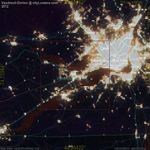
» Earth at Night: Flat Maps 2012, 2016