Pont Rouge night lights from space
Night Light of Pont Rouge (Quebec) from space (Canada) Src. Average luminocity for 10x10km area is 0.2827% and for 50x50km: 0.7874%.
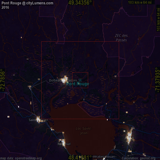
Analysis of Pont Rouge night lights 2016
Square area 10x10 km:
 0%
0%90-99
0%80-89
0%70-79
0%60-69
0%50-59
0%40-49
0.43%30-39
0.14%20-29
0%10-19
0%0-9
99.43%Square area 50x50 km:
0.11%90-99
0.14%80-89
0.07%70-79
0.05%60-69
0.16%50-59
0.03%40-49
0.06%30-39
0.14%20-29
0.08%10-19
0.52%0-9
98.64%Clear (daylight) street map image can be seen on geolist.org.
Map coordinates:
49° 20' 36.8" North, 72° 47' 8.2" West
48° 52' 60" North, 72° 4' 56.9" West
48° 25' 7.7" North, 71° 22' 45.7" West
Some cities around Pont Rouge sort by population:
• Saguenay
90.9 km =56.5 mi,  124°
124°
• Jonquière
80.3 km =49.9 mi,  130°
130°
• Alma
48.8 km =30.3 mi,  139°
139°
• Dolbeau-Mistassini
10.9 km =6.8 mi,  267°
267°
• La Tuque
169.4 km =105.3 mi,  197°
197°
• Roberval
42.2 km =26.2 mi, 195°
• Saint-Félicien
37.3 km =23.2 mi,  226°
226°
• Pointe-du-Lac
48 km =29.8 mi,  152°
152°
6110611 (p: 7,518)
Sources (retrieved 2019-11-25):
» Earth at Night: Flat Maps 2012, 2016