Okotoks night lights from space
Night Light of Okotoks (Alberta) from space (Canada) Src. Average luminocity for 10x10km area is 18.361% and for 50x50km: 6.8557%.
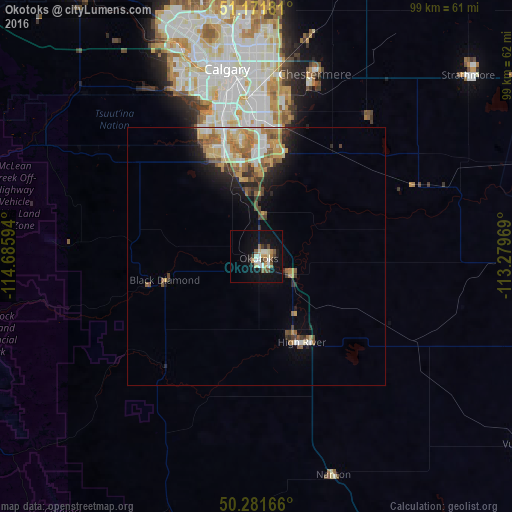
Analysis of Okotoks night lights 2016
Square area 10x10 km:
 2.01%
2.01%90-99
3.88%80-89
1.6%70-79
2.54%60-69
0.8%50-59
3.74%40-49
2.14%30-39
1.47%20-29
1.74%10-19
21.66%0-9
58.42%Square area 50x50 km:
0.8%90-99
1.14%80-89
0.71%70-79
1.53%60-69
1.19%50-59
1.09%40-49
0.68%30-39
0.76%20-29
1.38%10-19
3.22%0-9
87.5%Clear (daylight) street map image can be seen on geolist.org.
Map coordinates:
51° 10' 18.5" North, 114° 41' 9.4" West
50° 43' 43.9" North, 113° 58' 58.1" West
50° 16' 54" North, 113° 16' 46.9" West
Some cities around Okotoks sort by population:
• Calgary
36.4 km =22.6 mi,  348°
348°
• Airdrie
63.6 km =39.5 mi,  356°
356°
• Cochrane
60.9 km =37.8 mi,  326°
326°
• Strathmore
55.1 km =34.2 mi,  49°
49°
• Canmore
103.8 km =64.5 mi,  292°
292°
• High River
18.1 km =11.2 mi,  153°
153°
• Olds
117.5 km =73 mi, 355°
• Banff
121.8 km =75.7 mi, 294°
6093010 (p: 14,826)
Sources (retrieved 2019-11-25):
» Earth at Night: Flat Maps 2012, 2016