Wild Rose night lights from space
Night Light of Wild Rose (Alberta) from space (Canada) Src. Average luminocity for 10x10km area is 70.2169% and for 50x50km: 29.5179%.
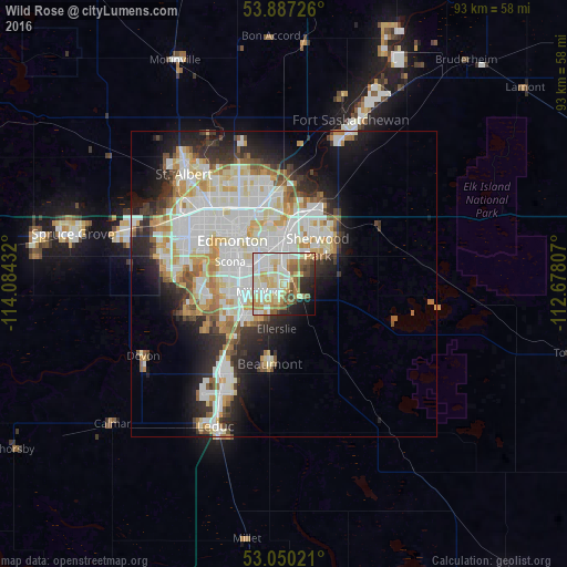
Analysis of Wild Rose night lights 2016
Square area 10x10 km:
 15.61%
90-99
21.3%80-89
14.81%70-79
7.41%60-69
9.66%50-59
7.28%40-49
4.89%30-39
2.65%20-29
7.01%10-19
6.75%0-9
2.65%Square area 50x50 km:
8.19%90-99
7.97%80-89
3.69%70-79
3.68%60-69
2.4%50-59
2.56%40-49
1.99%30-39
2.62%20-29
5.43%10-19
8.14%0-9
53.32%Clear (daylight) street map image can be seen on geolist.org.
Map coordinates:
53° 53' 14.1" North, 114° 5' 3.6" West
53° 28' 14.9" North, 113° 22' 52.3" West
53° 3' 0.8" North, 112° 40' 41.1" West
Some cities around Wild Rose sort by population:
• Edmonton
10.6 km =6.6 mi,  326°
326°
• St. Albert
24.7 km =15.3 mi,  317°
317°
• Sherwood Park
6.6 km =4.1 mi,  38°
38°
• Leduc
25.4 km =15.8 mi,  206°
206°
• Fort Saskatchewan
29.4 km =18.3 mi,  21°
21°
• Silver Berry
1.4 km =0.9 mi,  181°
181°
• Beaumont
13.6 km =8.5 mi,  190°
190°
• Devon
26.2 km =16.3 mi,  243°
243°
11203927 (p: 8,031)
Sources (retrieved 2019-11-25):
» Earth at Night: Flat Maps 2012, 2016