Cowansville night lights from space
Night Light of Cowansville (Quebec) from space (Canada) Src. Average luminocity for 10x10km area is 19.1364% and for 50x50km: 5.3778%.
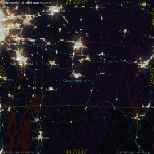
Analysis of Cowansville night lights 2016
Square area 10x10 km:
 2.42%
2.42%90-99
3.64%80-89
1.82%70-79
0.76%60-69
2.42%50-59
1.52%40-49
4.85%30-39
3.94%20-29
2.27%10-19
16.06%0-9
60.3%Square area 50x50 km:
0.7%90-99
0.89%80-89
0.51%70-79
0.44%60-69
0.58%50-59
0.61%40-49
0.91%30-39
0.95%20-29
1.42%10-19
3.1%0-9
89.87%Clear (daylight) street map image can be seen on geolist.org.
Map coordinates:
45° 41' 36.1" North, 73° 27' 8.1" West
45° 12' 0.3" North, 72° 44' 56.9" West
44° 42' 8.9" North, 72° 2' 45.6" West
Some cities around Cowansville sort by population:
• Saint-Jean-sur-Richelieu
41.9 km =26 mi,  286°
286°
• Granby
22.3 km =13.9 mi,  3°
3°
• Magog
47.6 km =29.6 mi,  81°
81°
• Farnham
20.5 km =12.7 mi,  296°
296°
• Lac-Brome
18.4 km =11.4 mi, 84°
• Marieville
41.6 km =25.8 mi,  308°
308°
• Saint-Pie
35.9 km =22.3 mi,  339°
339°
• Richelieu
47.3 km =29.4 mi, 304°
5931074 (p: 10,887)
Sources (retrieved 2019-11-25):
» Earth at Night: Flat Maps 2012, 2016