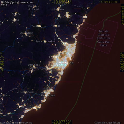
Vitória night lights from space
Night Light of Vitória (Espírito Santo) from space (Brazil) Src. Average luminocity for 10x10km area is 94.733% and for 50x50km: 28.1024%.

Analysis of Vitória night lights 2016
Square area 10x10 km:
 42.99%
90-99
37.88%80-89
7.39%70-79
7.58%60-69
3.03%50-59
1.14%40-49
0%30-39
0%20-29
0%10-19
0%0-9
0%Square area 50x50 km:
6.18%90-99
6.03%80-89
3.93%70-79
4.85%60-69
2.05%50-59
2.51%40-49
3.74%30-39
2.74%20-29
7.11%10-19
10.3%0-9
50.56%Clear (daylight) street map image can be seen on geolist.org.
Map coordinates:
19° 39' 31.2" South, 41° 2' 27.3" West
20° 19' 10" South, 40° 20' 16" West
20° 58' 38.6" South, 39° 38' 4.8" West
Some cities around Vitória sort by population:
• Vila Velha
4.9 km =3 mi,  103°
103°
• Serra
21.4 km =13.3 mi,  8°
8°
• Guarapari
42.7 km =26.5 mi,  203°
203°
• Viana
18.3 km =11.4 mi,  244°
244°
• Fundão
43.4 km =27 mi,  350°
350°
• Domingos Martins
33.9 km =21.1 mi,  261°
261°
• Jetibá
48.9 km =30.4 mi,  312°
312°
• Marechal Floriano
37.5 km =23.3 mi,  253°
253°
3444924 (p: 312,656)
Sources (retrieved 2019-11-25):
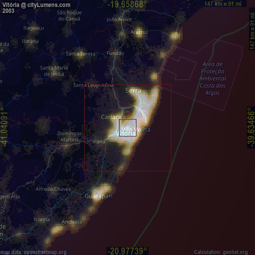
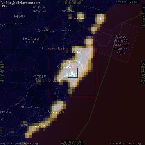
» NASA, Earths city lights 1995
» NASA city lights 2003
» Earth at Night: Flat Maps 2012, 2016