Viamão night lights from space
Night Light of Viamão (Rio Grande do Sul) from space (Brazil) Src. Average luminocity for 10x10km area is 49.4924% and for 50x50km: 34.8729%.
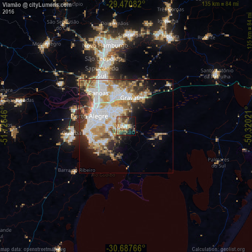
Analysis of Viamão night lights 2016
Square area 10x10 km:
 4.17%
4.17%90-99
4.17%80-89
12.69%70-79
8.71%60-69
10.23%50-59
9.47%40-49
9.28%30-39
7.77%20-29
12.12%10-19
17.23%0-9
4.17%Square area 50x50 km:
10.04%90-99
6.2%80-89
4.94%70-79
4.62%60-69
4.83%50-59
4.4%40-49
3.45%30-39
3.71%20-29
5.17%10-19
6.49%0-9
46.15%Clear (daylight) street map image can be seen on geolist.org.
Map coordinates:
29° 28' 15" South, 51° 43' 35.3" West
30° 4' 52" South, 51° 1' 24" West
30° 41' 15.6" South, 50° 19' 12.8" West
Some cities around Viamão sort by population:
• Porto Alegre
20.6 km =12.8 mi,  285°
285°
• Canoas
23.8 km =14.8 mi,  319°
319°
• Gravataí
15.7 km =9.8 mi,  10°
10°
• São Leopoldo
37.6 km =23.4 mi,  341°
341°
• Sapucaia
30.1 km =18.7 mi, 336°
• Cachoeirinha
16 km =9.9 mi,  334°
334°
• Guaíba
29.2 km =18.1 mi,  262°
262°
• Esteio
28.7 km =17.8 mi, 328°
3445156 (p: 285,269)
Sources (retrieved 2019-11-25):
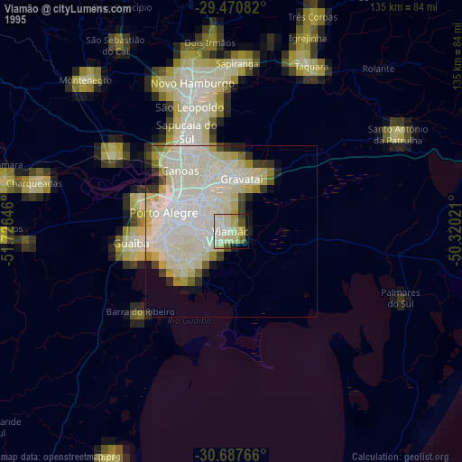
» NASA, Earths city lights 1995
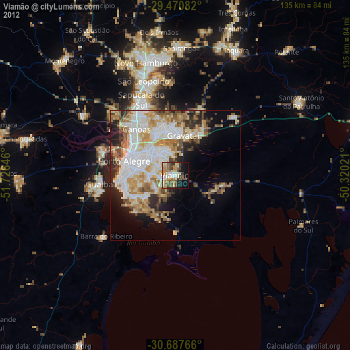
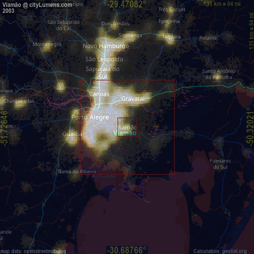
» NASA city lights 2003
» Earth at Night: Flat Maps 2012, 2016