Umuarama night lights from space
Night Light of Umuarama (Paraná) from space (Brazil) Src. Average luminocity for 10x10km area is 60.7758% and for 50x50km: 5.0434%.
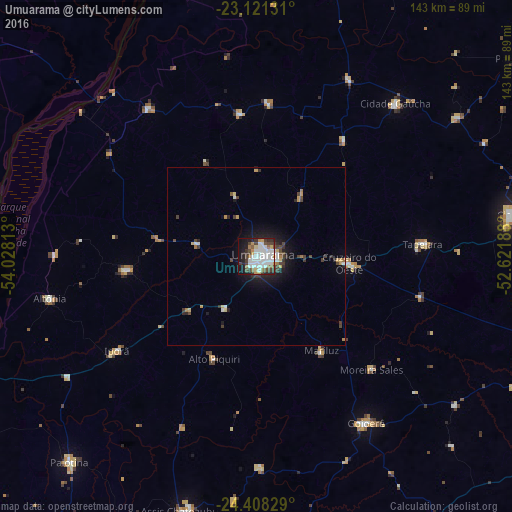
Analysis of Umuarama night lights 2016
Square area 10x10 km:
 22.02%
90-99
16.47%80-89
2.98%70-79
4.96%60-69
5.16%50-59
2.98%40-49
8.73%30-39
8.93%20-29
7.34%10-19
18.25%0-9
2.18%Square area 50x50 km:
1.04%90-99
0.83%80-89
0.35%70-79
0.6%60-69
0.45%50-59
0.16%40-49
1.05%30-39
0.99%20-29
1.05%10-19
3.34%0-9
90.15%Clear (daylight) street map image can be seen on geolist.org.
Map coordinates:
23° 7' 16.7" South, 54° 1' 41.3" West
23° 45' 59" South, 53° 19' 30" West
24° 24' 29.8" South, 52° 37' 18.8" West
Some cities around Umuarama sort by population:
• Cianorte
74.2 km =46.1 mi,  81°
81°
• Palotina
77.8 km =48.3 mi,  222°
222°
• Cruzeiro do Oeste
25.7 km =16 mi,  94°
94°
• Altãnia
59.9 km =37.2 mi,  258°
258°
• Tapejara
46.1 km =28.6 mi, 85°
• Iporã
46.7 km =29 mi,  235°
235°
• Alto Piquiri
31.4 km =19.5 mi,  201°
201°
• Moreira Sales
46.1 km =28.6 mi,  135°
135°
3445782 (p: 107,319)
Sources (retrieved 2019-11-25):
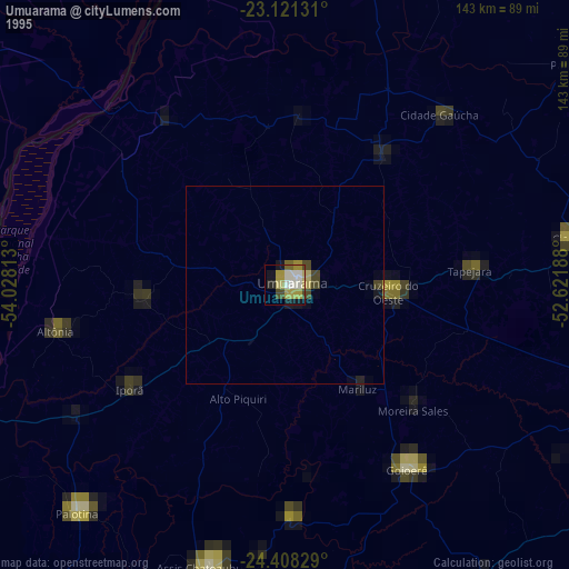
» NASA, Earths city lights 1995
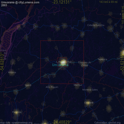
» NASA city lights 2003
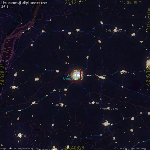
» Earth at Night: Flat Maps 2012, 2016