Tupanatinga night lights from space
Night Light of Tupanatinga (Pernambuco) from space (Brazil) Src. Average luminocity for 10x10km area is 4.7893% and for 50x50km: 0.8351%.
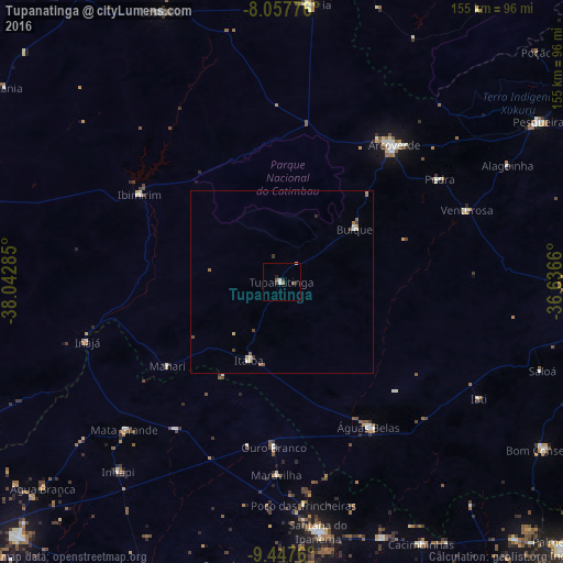
Analysis of Tupanatinga night lights 2016
Square area 10x10 km:
 1.03%
1.03%90-99
0.62%80-89
0.21%70-79
0.21%60-69
0.83%50-59
1.45%40-49
0.21%30-39
0.83%20-29
1.65%10-19
0.83%0-9
92.15%Square area 50x50 km:
0.1%90-99
0.13%80-89
0.11%70-79
0.08%60-69
0.14%50-59
0.19%40-49
0.09%30-39
0.19%20-29
0.1%10-19
0.03%0-9
98.82%Clear (daylight) street map image can be seen on geolist.org.
Map coordinates:
8° 3' 27.9" South, 38° 2' 34.3" West
8° 45' 12" South, 37° 20' 23" West
9° 26' 51.4" South, 36° 38' 11.8" West
Some cities around Tupanatinga sort by population:
• Arcoverde
48.7 km =30.3 mi,  40°
40°
• Águas Belas
46.4 km =28.8 mi,  149°
149°
• Buíque
24.9 km =15.5 mi,  54°
54°
• Itaíba
23.4 km =14.5 mi,  202°
202°
• Ibimirim
45.2 km =28.1 mi,  301°
301°
• Pedra
52.3 km =32.5 mi,  56°
56°
• Inhapi
68.7 km =42.7 mi,  220°
220°
• Carnaíba
36.4 km =22.6 mi,  279°
279°
3385920 (p: 5,768)
Sources (retrieved 2019-11-25):
» Earth at Night: Flat Maps 2012, 2016