Paulínia night lights from space
Night Light of Paulínia (São Paulo) from space (Brazil) Src. Average luminocity for 10x10km area is 83.9226% and for 50x50km: 53.0295%.
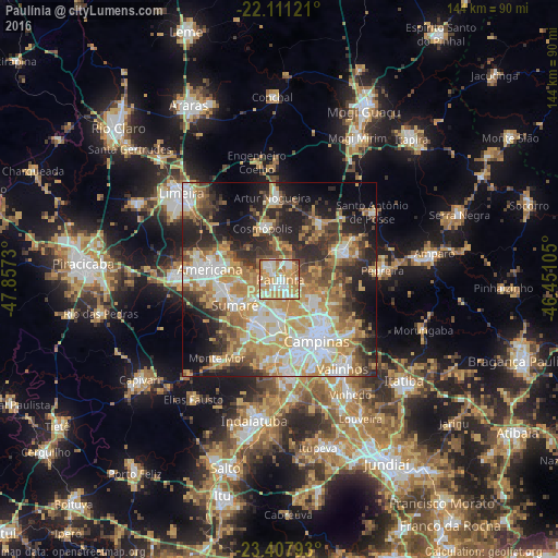
Analysis of Paulínia night lights 2016
Square area 10x10 km:
 19.44%
90-99
22.02%80-89
15.67%70-79
25.6%60-69
14.48%50-59
1.59%40-49
1.19%30-39
0%20-29
0%10-19
0%0-9
0%Square area 50x50 km:
9.55%90-99
9.96%80-89
8.17%70-79
11.6%60-69
8.29%50-59
5.27%40-49
6.37%30-39
7.03%20-29
11.36%10-19
11.53%0-9
10.87%Clear (daylight) street map image can be seen on geolist.org.
Map coordinates:
22° 6' 40.4" South, 47° 51' 26.3" West
22° 45' 40" South, 47° 9' 15" West
23° 24' 28.5" South, 46° 27' 3.8" West
Some cities around Paulínia sort by population:
• Campinas
18.7 km =11.6 mi,  149°
149°
• Sumaré
13.4 km =8.3 mi,  239°
239°
• Hortolândia
12.7 km =7.9 mi,  211°
211°
• Americana
18.3 km =11.4 mi,  277°
277°
• Nova Odessa
14.6 km =9.1 mi,  262°
262°
• Cosmópolis
13.5 km =8.4 mi,  341°
341°
• Artur Nogueira
21 km =13 mi,  354°
354°
• Jaguariúna
18.3 km =11.4 mi,  70°
70°
3454690 (p: 65,595)
Sources (retrieved 2019-11-25):
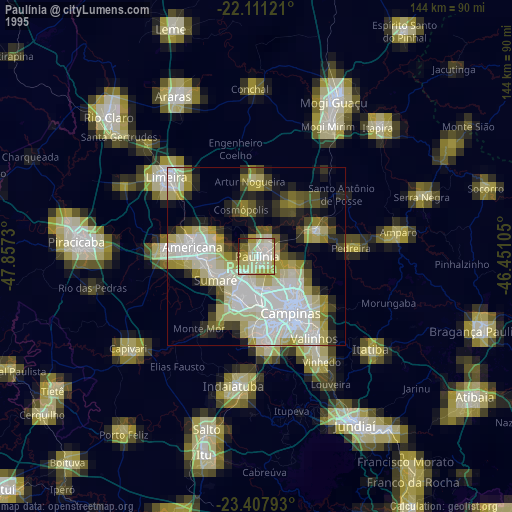
» NASA, Earths city lights 1995
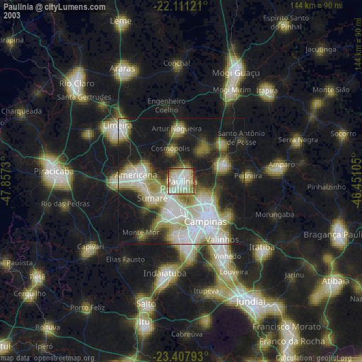
» NASA city lights 2003
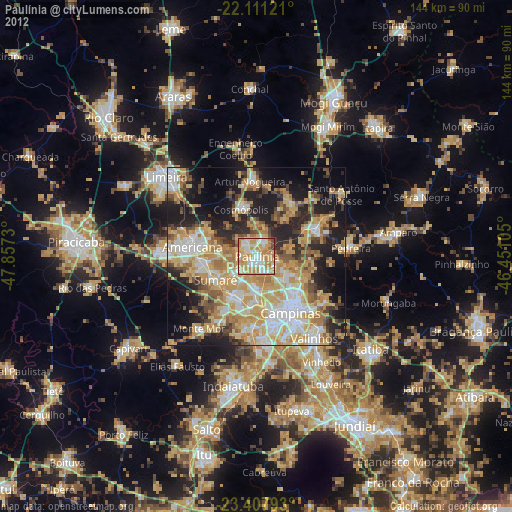
» Earth at Night: Flat Maps 2012, 2016