São João da Boa Vista night lights from space
Night Light of São João da Boa Vista (São Paulo) from space (Brazil) Src. Average luminocity for 10x10km area is 43.8909% and for 50x50km: 9.2343%.
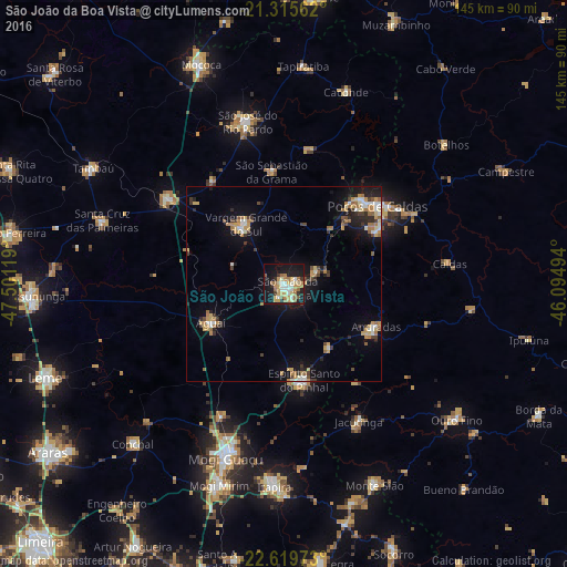
Analysis of São João da Boa Vista night lights 2016
Square area 10x10 km:
 5.16%
5.16%90-99
6.94%80-89
9.13%70-79
9.92%60-69
8.73%50-59
5.36%40-49
0%30-39
2.58%20-29
6.75%10-19
37.1%0-9
8.33%Square area 50x50 km:
0.87%90-99
1.1%80-89
1.12%70-79
1.84%60-69
1.72%50-59
0.78%40-49
0.86%30-39
1.15%20-29
1.85%10-19
6.6%0-9
82.11%Clear (daylight) street map image can be seen on geolist.org.
Map coordinates:
21° 18' 56.2" South, 47° 30' 4.3" West
21° 58' 9" South, 46° 47' 53" West
22° 37' 11" South, 46° 5' 41.8" West
Some cities around São João da Boa Vista sort by population:
• Poços de Caldas
31.7 km =19.7 mi,  50°
50°
• Mogi Guaçu
46.8 km =29.1 mi,  198°
198°
• Espírito Santo do Pinhal
20.2 km =12.6 mi,  143°
143°
• Vargem Grande do Sul
18.1 km =11.2 mi,  327°
327°
• Aguaí
21.1 km =13.1 mi,  241°
241°
• Andradas
26 km =16.2 mi,  114°
114°
• Casa Branca
36.8 km =22.9 mi,  306°
306°
• Jacutinga
40 km =24.9 mi,  151°
151°
3448902 (p: 76,540)
Sources (retrieved 2019-11-25):
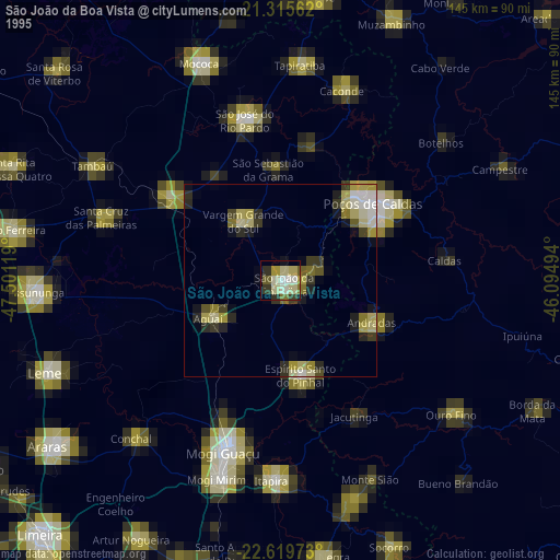
» NASA, Earths city lights 1995
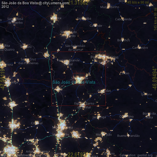
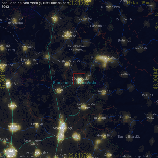
» NASA city lights 2003
» Earth at Night: Flat Maps 2012, 2016