Vargem Grande do Sul night lights from space
Night Light of Vargem Grande do Sul (São Paulo) from space (Brazil) Src. Average luminocity for 10x10km area is 24.0218% and for 50x50km: 6.6748%.
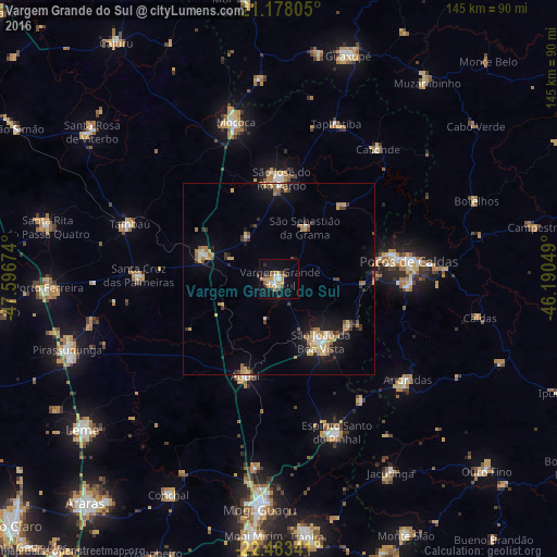
Analysis of Vargem Grande do Sul night lights 2016
Square area 10x10 km:
 2.58%
2.58%90-99
3.17%80-89
1.79%70-79
7.54%60-69
3.97%50-59
1.59%40-49
2.98%30-39
2.78%20-29
0.6%10-19
19.64%0-9
53.37%Square area 50x50 km:
0.41%90-99
0.67%80-89
0.8%70-79
1.34%60-69
1.43%50-59
0.49%40-49
0.72%30-39
1.02%20-29
0.84%10-19
5.04%0-9
87.25%Clear (daylight) street map image can be seen on geolist.org.
Map coordinates:
21° 10' 41" South, 47° 35' 48.3" West
21° 49' 56" South, 46° 53' 37" West
22° 29' 0.3" South, 46° 11' 25.8" West
Some cities around Vargem Grande do Sul sort by population:
• Poços de Caldas
34.6 km =21.5 mi,  81°
81°
• São João da Boa Vista
18.1 km =11.2 mi,  147°
147°
• São José do Rio Pardo
26.3 km =16.3 mi,  1°
1°
• Espírito Santo do Pinhal
38.3 km =23.8 mi, 145°
• Aguaí
26.7 km =16.6 mi,  199°
199°
• Santa Cruz das Palmeiras
36.6 km =22.7 mi,  270°
270°
• Casa Branca
20.9 km =13 mi,  288°
288°
• Tambaú
41.8 km =26 mi, 289°
3445500 (p: 36,213)
Sources (retrieved 2019-11-25):
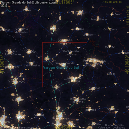
» Earth at Night: Flat Maps 2012, 2016