Barra dos Coqueiros night lights from space
Night Light of Barra dos Coqueiros (Sergipe) from space (Brazil) Src. Average luminocity for 10x10km area is 85.9762% and for 50x50km: 27.7572%.
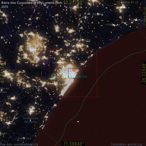
Analysis of Barra dos Coqueiros night lights 2016
Square area 10x10 km:
 43.07%
90-99
24.89%80-89
4.55%70-79
3.03%60-69
8.44%50-59
7.79%40-49
1.52%30-39
3.46%20-29
3.25%10-19
0%0-9
0%Square area 50x50 km:
5.99%90-99
6.19%80-89
2.09%70-79
1.74%60-69
3.19%50-59
4.46%40-49
4.02%30-39
4.83%20-29
7.56%10-19
14.66%0-9
45.28%Clear (daylight) street map image can be seen on geolist.org.
Map coordinates:
10° 13' 3.7" South, 37° 44' 30.3" West
10° 54' 32" South, 37° 2' 19" West
11° 35' 54.6" South, 36° 20' 7.8" West
Some cities around Barra dos Coqueiros sort by population:
• Aracaju
3.6 km =2.2 mi,  266°
266°
• Nossa Senhora do Socorro
11.3 km =7 mi,  302°
302°
• São Cristóvão
21.8 km =13.5 mi,  237°
237°
• Laranjeiras
18.3 km =11.4 mi,  308°
308°
• Maruim
19.6 km =12.2 mi,  346°
346°
• Santo Amaro das Brotas
13.5 km =8.4 mi, 352°
• Japaratuba
36.7 km =22.8 mi,  17°
17°
• Areia Branca
34.6 km =21.5 mi, 299°
3470674 (p: 28,586)
Sources (retrieved 2019-11-25):
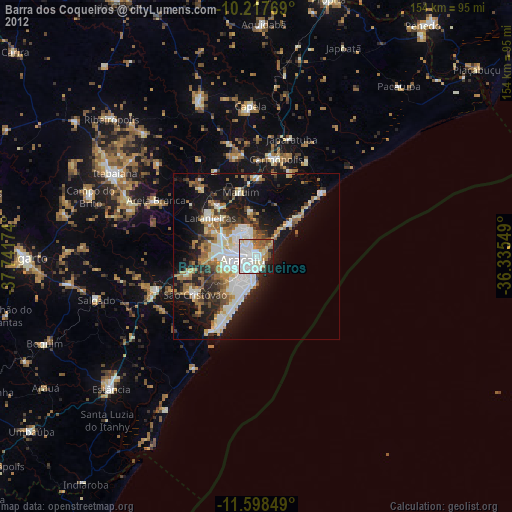
» Earth at Night: Flat Maps 2012, 2016