Santo Estêvão night lights from space
Night Light of Santo Estêvão (Bahia) from space (Brazil) Src. Average luminocity for 10x10km area is 51.1405% and for 50x50km: 12.2267%.
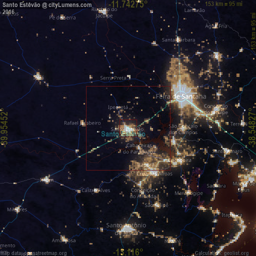
Analysis of Santo Estêvão night lights 2016
Square area 10x10 km:
 4.75%
4.75%90-99
9.92%80-89
2.89%70-79
9.5%60-69
11.57%50-59
13.02%40-49
9.5%30-39
6.82%20-29
13.02%10-19
19.01%0-9
0%Square area 50x50 km:
0.26%90-99
1.07%80-89
0.58%70-79
1.26%60-69
2.06%50-59
3.91%40-49
3.62%30-39
3.36%20-29
3.79%10-19
9.35%0-9
70.73%Clear (daylight) street map image can be seen on geolist.org.
Map coordinates:
11° 44' 33.9" South, 39° 57' 16.3" West
12° 25' 49" South, 39° 15' 5" West
13° 6' 57.6" South, 38° 32' 53.8" West
Some cities around Santo Estêvão sort by population:
• Feira de Santana
35.9 km =22.3 mi,  59°
59°
• Cruz das Almas
31.2 km =19.4 mi,  148°
148°
• Cachoeira
36.4 km =22.6 mi,  121°
121°
• Conceição da Feira
28.7 km =17.8 mi,  107°
107°
• São Gonçalo dos Campos
30.9 km =19.2 mi,  90°
90°
• Castro Alves
41.9 km =26 mi,  207°
207°
• Anguera
31 km =19.3 mi,  1°
1°
• Conceição do Almeida
39.8 km =24.7 mi,  167°
167°
3449467 (p: 27,279)
Sources (retrieved 2019-11-25):
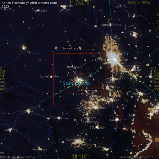
» Earth at Night: Flat Maps 2012, 2016