Cruz das Almas night lights from space
Night Light of Cruz das Almas (Bahia) from space (Brazil) Src. Average luminocity for 10x10km area is 55.9177% and for 50x50km: 19.6741%.
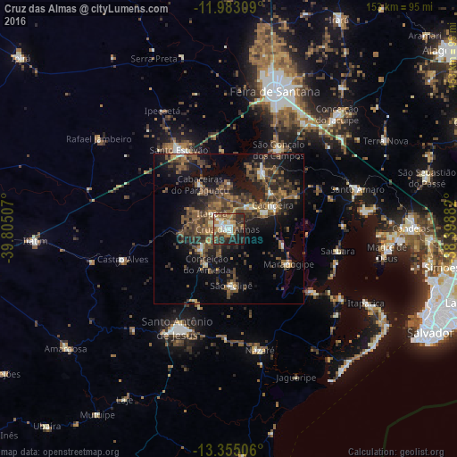
Analysis of Cruz das Almas night lights 2016
Square area 10x10 km:
 4.76%
4.76%90-99
16.02%80-89
4.76%70-79
9.52%60-69
8.23%50-59
13.2%40-49
5.63%30-39
10.17%20-29
19.05%10-19
8.66%0-9
0%Square area 50x50 km:
0.41%90-99
2.21%80-89
1.05%70-79
1.62%60-69
3.42%50-59
6.21%40-49
5.45%30-39
5.66%20-29
7.03%10-19
13.53%0-9
53.42%Clear (daylight) street map image can be seen on geolist.org.
Map coordinates:
11° 58' 59.1" South, 39° 48' 18.3" West
12° 40' 12" South, 39° 6' 7" West
13° 21' 18.2" South, 38° 23' 55.8" West
Some cities around Cruz das Almas sort by population:
• Santo Estêvão
31.2 km =19.4 mi,  328°
328°
• Muritiba
31.8 km =19.8 mi,  210°
210°
• Maragogipe
23.1 km =14.4 mi,  121°
121°
• Sobradinho
18.2 km =11.3 mi,  179°
179°
• Cachoeira
16.6 km =10.3 mi,  62°
62°
• Conceição da Feira
21.4 km =13.3 mi,  31°
31°
• São Gonçalo dos Campos
30.1 km =18.7 mi, 29°
• Conceição do Almeida
14.2 km =8.8 mi, 211°
3465105 (p: 47,844)
Sources (retrieved 2019-11-25):
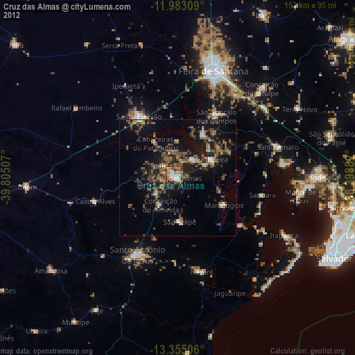
» Earth at Night: Flat Maps 2012, 2016