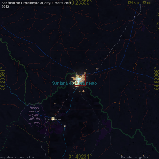
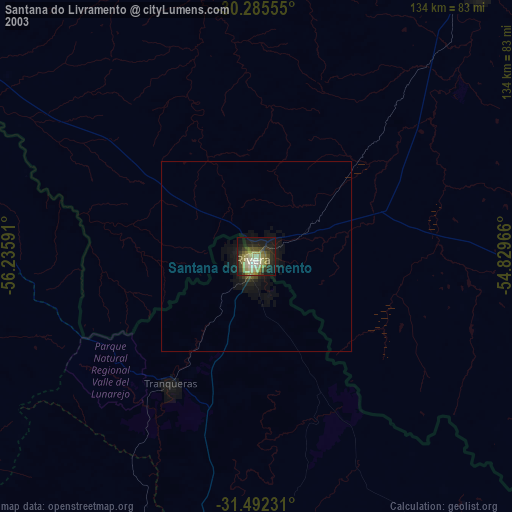
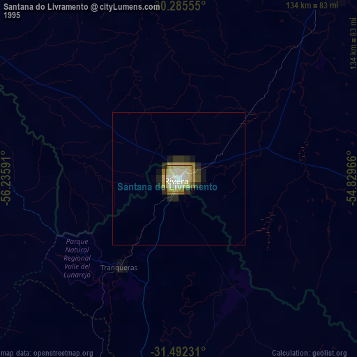
Santana do Livramento night lights from space
Night Light of Santana do Livramento (Rio Grande do Sul) from space (Brazil) Src. Average luminocity for 10x10km area is 60.7745% and for 50x50km: 3.6135%.
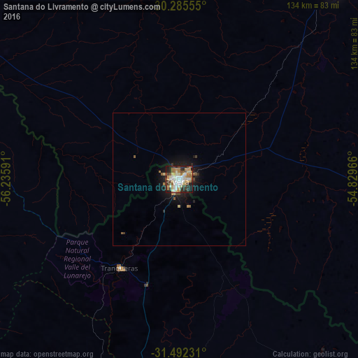
Analysis of Santana do Livramento night lights 2016
Square area 10x10 km:
 9.62%
9.62%90-99
15.73%80-89
8.92%70-79
8.92%60-69
11.89%50-59
4.55%40-49
8.39%30-39
9.79%20-29
12.41%10-19
9.79%0-9
0%Square area 50x50 km:
0.4%90-99
0.66%80-89
0.43%70-79
0.43%60-69
0.6%50-59
0.37%40-49
0.46%30-39
0.54%20-29
0.82%10-19
3.01%0-9
92.27%Clear (daylight) street map image can be seen on geolist.org.
Map coordinates:
30° 17' 8" South, 56° 14' 9.3" West
30° 53' 27" South, 55° 31' 58" West
31° 29' 32.3" South, 54° 49' 46.8" West
Some cities around Santana do Livramento sort by population:
• Alegrete
125.7 km =78.1 mi,  348°
348°
• Rivera, UY
2.4 km =1.5 mi,  226°
226°
• Tacuarembó, UY
101.2 km =62.9 mi,  204°
204°
• Artigas, UY
104.7 km =65.1 mi,  301°
301°
• Dom Pedrito
82.6 km =51.3 mi,  97°
97°
• Rosário do Sul
91.9 km =57.1 mi,  40°
40°
• Quaraí
104.2 km =64.7 mi, 302°
• Tranqueras, UY
40.1 km =24.9 mi,  211°
211°
3449936 (p: 89,694)
Sources (retrieved 2019-11-25):
» NASA, Earths city lights 1995
» NASA city lights 2003
» Earth at Night: Flat Maps 2012, 2016